Publications by White, W.A.
| Title | Publication Year Sort ascending | Abstract | Author | Series | Publisher | |
|---|---|---|---|---|---|---|
|
Submerged lands of Texas, Galveston - Houston area: sediments, geochemistry, benthic macroinvertebrates, and associated wetlands | 1985 | The State-owned submerged lands of Texas encompass almost 6,000 mi2 (15,540 km2). They lie below waters of the bay-estuary-lagoon system and the Gulf of Mexico and extend 10.3 mi (16.6 km) seaward from the Gulf shoreline (fig. 1). |
White, W.A., Calnan, T.R., Morton, R.A., Kimble, R.S., Littleton, T.G., McGowen, J.H., Nance, H.S., Schmedes, K.E. | Submerged Lands of Texas | Bureau of Economic Geology |
|
Submerged lands of Texas, Corpus Christi area: sediments, geochemistry, benthic macroinvertebrates, and associated wetlands | 1983 | The State-owned submerged lands of Texas encompass almost 6,000 mi2 (15,540 km2). They lie below waters of the bay-estuary-lagoon system and the Gulf of Mexico and extend 10.3 mi (16.6 km) seaward from the Gulf shoreline (fig. 1). |
White, W.A., Calnan, T.R., Morton, R.A., Kimble, R.S., Littleton, T.G., McGowen, J.H., Nance, H.S., Schmedes, K.E. | Submerged Lands of Texas | Bureau of Economic Geology |
|
Environmental geologic Atlas of the Texas coastal zone -- Brownsville-Harlingen area | 1980 | The Texas Coastal Zone is marked by diversity in geography, resources, climate, and industry. |
Brown, L.F., Jr., Brewton, J.L., Evans, T.J., McGowen, J.H., White, W.A., Groat, C.G., Fisher, W.L. | Environmental Geologic Atlas of the Texas Coastal Zone | Bureau of Economic Geology |
|
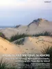
Padre Island National Seashore -- a guide to the geology, natural environments, and history of a Texas barrier island | 1980 | For the past decade, geologists at the Bureau of Economic Geology, The University of Texas at Austin, have prepared various maps of the Texas Coastal Zone. |
Weise, B.R., White, W.A. | Guidebook | Bureau of Economic Geology |
|
Land and water resources, historical changes, and dune criticality: Mustang and North Padre Islands, Texas | 1978 | Barrier islands along the Texas Coastal Zone are part of a complex and dynamic system represented by many distinct yet interrelated environments affected by a variety of resources, natural processes, climatic conditions, and human activities. |
White, W.A., Morton, R.A., Kerr, R.S., Kuenzi, W.D., Brogden, W.B. | Report of Investigations | Bureau of Economic Geology |
|
Land and water resources of the Corpus Christi area, Texas | 1978 | Land and water resources have been analyzed in the Corpus Christi area--Aransas, Nueces, Refugio, and San Patricio Counties along the central Texas coast. The city and port of Corpus Christi compose the largest metropolitan center in the area. |
Kier, R.S., White, W.A. | Report of Investigations | Bureau of Economic Geology |
|
Guide to modern barrier environments of Mustang and North Padre Islands and Jackson (Eocene) barrier/lagoon facies of the south Texas uranium district | 1976 | Combining process and geomorphic description (supplied by studies of modern depositional systems) with the three-dimensional description of sedimentary units and their internal structures (accomplished in the stratigraphic record) produces an integrated facies model that can be applied to the int |
White, W.A., Galloway, W.E. | Research Note |