|
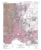
Geologic map of the Ysleta quadrangle, Texas |
1995 |
|
Collins, E.W., Raney, J.A. |
Open-File Map |
Bureau of Economic Geology |
|
Geologic map of the Clint quadrangle, Texas |
1995 |
|
Collins, E.W., Raney, J.A. |
Open-File Map |
Bureau of Economic Geology |
|
Geologic map of the Clint NE quadrangle, Texas |
1995 |
|
Collins, E.W., Raney, J.A. |
Open-File Map |
Bureau of Economic Geology |
|
Geologic map of the Clint NW quadrangle, Texas |
1995 |
|
Collins, E.W., Raney, J.A. |
Open-File Map |
Bureau of Economic Geology |
|
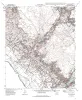
Geologic map of the El Paso Quadrangle, Texas |
1994 |
|
Collins, E.W., Raney, J.A. |
Open-File Map |
Bureau of Economic Geology |
|
Geologic map of the Fort Hancock quadrangle, Texas |
1994 |
|
Collins, E.W., Raney, J.A. |
Open-File Map |
Bureau of Economic Geology |
|
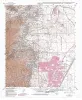
Geologic map of the North Franklin Mountain Quadrangle, Texas |
1994 |
|
Raney, J.A., Collins, E.W. |
Open-File Map |
Bureau of Economic Geology |
|
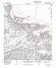
Geologic map of the Diablo Canyon West quadrangle, Texas |
1994 |
|
Collins, E.W., Raney, J.A. |
Open-File Map |
Bureau of Economic Geology |
|
Geologic map of the Campo Grande Mountain quadrangle, Texas |
1994 |
|
Collins, E.W., Raney, J.A. |
Open-File Map |
Bureau of Economic Geology |
|
Geologic map of the Sattler quadrangle, Texas |
1991 |
|
Collins, E.W., Baumgardner, R.W., Jr., Raney, J.A. |
Open-File Map |
Bureau of Economic Geology |