Publications by Raney, J.A.
| Title | Publication Year Sort ascending | Abstract | Author | Series | Publisher | |
|---|---|---|---|---|---|---|
|
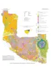
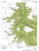
Down to earth at Big Bend Ranch State Park, Texas: geologic map and trail-side geology | 2002 | This full-color, oversize map, designed for hikers in the park, describes geologic units and features. The text documents the geologic history of the Big Bend Ranch State Park area. Support was provided by the Texas Parks and Wildlife Department and the U.S. Geological Survey. |
Henry, C.D., Raney, J.A. | Down To Earth | Bureau of Economic Geology |
|
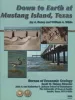
Down to Earth at Mustang Island, Texas | 2002 | Beautifully illustrated by more than 100 photos and diagrams, this nontechnical guide surveys the geologic evolution of Mustang Island and the relationship between physical setting and biologic environments along the Texas coast. |
Raney, J.A., White, W.A. | Down To Earth | Bureau of Economic Geology |
|
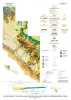
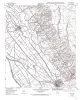
Geologic map of the central Hueco Bolson, Acala - Fort Hancock - Esperanza region, Texas | 2002 | Collins, E.W., Raney, J.A. | Miscellaneous Map | Bureau of Economic Geology | |
|
Geologic Map of West Hueco Bolson, El Paso Region, Texas | 2000 | Collins, E.W., Raney, J.A. | Miscellaneous Map | Bureau of Economic Geology | |
|
Geologic map of the Fortress Cliff Quadrangle, Texas | 1998 | Raney, J.A., Collins, E.W. | Open-File Map | Bureau of Economic Geology | |
|
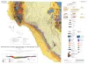
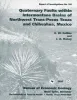
Quaternary faults within intermontane basins of northwest Trans-Pecos Texas and Chihuahua, Mexico | 1997 | This report details the occurrence, geometries, scarp morphology, and paleorupture histories of Quaternary faults of northwest Trans-Pecos Texas and northern Chihuahua, Mexico. |
Collins, E.W., Raney, J.A. | Report of Investigations | Bureau of Economic Geology |
|
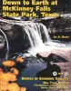
Down to earth at McKinney Falls State Park, Texas | 1997 | Written in an informal style for a nontechnical audience, this guide summarizes geologic features and history of McKinney Falls State Park, just south of Austin, Texas. |
Raney, J.A. | Down To Earth | Bureau of Economic Geology |
|
Geologic map of the Clint quadrangle, Texas | 1995 | Collins, E.W., Raney, J.A. | Open-File Map | Bureau of Economic Geology | |
|
Geologic map of the Clint NE quadrangle, Texas | 1995 | Collins, E.W., Raney, J.A. | Open-File Map | Bureau of Economic Geology | |
|
Geologic map of the Clint NW quadrangle, Texas | 1995 | Collins, E.W., Raney, J.A. | Open-File Map | Bureau of Economic Geology |