Publication Search

Publications by Paine, J.G.

Title Publication Year Sort ascending Abstract Author Series Publisher
Geologic map of the Mission Bay quadrangle: Mission Delta and Copano Bay area, Texas Gulf of Mexico Coast Geologic map of the Mission Bay quadrangle: Mission Delta and Copano Bay area, Texas Gulf of Mexico Coast 2014 Paine, J.G., Collins, E.W. Open-File Map Bureau of Economic Geology
Geologic map of the Guadalupe delta, Texas Gulf of Mexico Coast: Sheet 1-Austwell quadrangle Geologic map of the Guadalupe delta, Texas Gulf of Mexico Coast: Sheet 1-Austwell quadrangle 2013 Paine, J.G., Collins, E.W. Open-File Map Bureau of Economic Geology
Geologic map of the Guadalupe delta, Texas Gulf of Mexico Coast: Sheet 2-Bloomington SW quadrangle Geologic map of the Guadalupe delta, Texas Gulf of Mexico Coast: Sheet 2-Bloomington SW quadrangle 2013 Collins, E.W., Paine, J.G. Open-File Map Bureau of Economic Geology
Geologic map of the Guadalupe delta, Texas Gulf of Mexico Coast: Sheet 3-Green Lake quadrangle Geologic map of the Guadalupe delta, Texas Gulf of Mexico Coast: Sheet 3-Green Lake quadrangle 2013 Paine, J.G., Collins, E.W. Open-File Map Bureau of Economic Geology
Geologic map of the Guadalupe delta, Texas Gulf of Mexico Coast: Sheet 4-Sea Drift quadrangle Geologic map of the Guadalupe delta, Texas Gulf of Mexico Coast: Sheet 4-Sea Drift quadrangle 2013 Collins, E.W., Paine, J.G. Open-File Map Bureau of Economic Geology
Geologic map of the Guadalupe delta, Texas Gulf of Mexico Coast: Sheet 5-Tivoli quadrangle Geologic map of the Guadalupe delta, Texas Gulf of Mexico Coast: Sheet 5-Tivoli quadrangle 2013 Collins, E.W., Paine, J.G. Open-File Map Bureau of Economic Geology
Geologic map of the Nueces Delta-Annaville and Odem quadrangles, Texas Gulf Coast Geologic map of the Nueces Delta-Annaville and Odem quadrangles, Texas Gulf Coast 2012 Paine, J.G., Collins, E.W. Open-File Map Bureau of Economic Geology
Geoenvironmental map of Matagorda - Matagorda SW quadrangles, Texas Gulf of Mexico Coast Geoenvironmental map of Matagorda - Matagorda SW quadrangles, Texas Gulf of Mexico Coast 2011 Tremblay, T.A., Collins, E.W., Paine, J.G. Open-File Map Bureau of Economic Geology
Pavement Deflection and Seismic Refraction for Determining Bedrock Type, Depth, and Physical Properties beneath Roads Pavement Deflection and Seismic Refraction for Determining Bedrock Type, Depth, and Physical Properties beneath Roads 2000

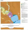
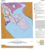
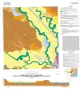
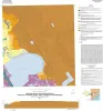
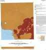
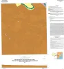
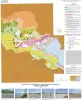
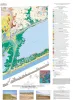
We examined the relationship between three data types--geologic maps, measurements of pavement deflection under load, and seismic refraction data-- from diverse geologic settings in Texas to determine (1) whether geologic maps and seismic refraction data might be used to interpret deflections and

Paine, J.G., Murphy, M.R. Report of Investigations Bureau of Economic Geology
Using airborne geophysics to identify salinization in West Texas Using airborne geophysics to identify salinization in West Texas 1999

Salinization of soil and water is a chronic environmental and agricultural problem in arid regions.

Paine, J.G., Dutton, A.R., Blum, M.U. Report of Investigations Bureau of Economic Geology