|
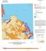
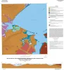
Geologic map of the Port Lavaca West quadrangle, Texas Gulf of Mexico coast |
2019 |
|
Paine, J.G., Costard, L. |
Open-File Map |
Bureau of Economic Geology |
|
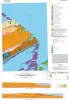
Geologic map of the Kamey quadrangle, Texas Gulf of Mexico Coast |
2018 |
|
Paine, J.G., Collins, E.W., Costard, L. |
Open-File Map |
Bureau of Economic Geology |
|
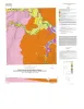
Geologic map of the Point Comfort quadrangle, Texas Gulf of Mexico Coast |
2018 |
|
Paine, J.G., Collins, E.W., Costard, L. |
Open-File Map |
Bureau of Economic Geology |
|
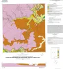
Geologic Map of the Seadrift NE Quadrangle, Texas Gulf of Mexico Coast |
2017 |
|
Paine, J.G., Collins, E.W. |
Open-File Map |
Bureau of Economic Geology |
|
Geologic Map of the Port Lavaca East Quadrangle, Texas Gulf of Mexico Coast |
2017 |
|
Paine, J.G., Collins, E.W. |
Open-File Map |
Bureau of Economic Geology |
|
Geologic map of Port O'Connor quadrangle, Texas Gulf of Mexico coast |
2016 |
|
Paine, J.G., Collins, E.W. |
Open-File Map |
Bureau of Economic Geology |

|
Geologic map of the Saint Charles Bay quadrangle, Texas Gulf of Mexico coast |
2016 |
|
Paine, J.G., Collins, E.W. |
Open-File Map |
Bureau of Economic Geology |
|
Geologic map of the Rincon Bend quadrangle, Aransas River and Copano Bay area, Texas Gulf of Mexico coast |
2015 |
|
Paine, J.G., Collins, E.W., Costard, L. |
Open-File Map |
Bureau of Economic Geology |
|
Geologic map of the Woodsboro quadrangle: Aransas and Mission Rivers, and Copano Bay area, Texas Gulf of Mexico Coast |
2015 |
|
Paine, J.G., Collins, E.W., Costard, L. |
Open-File Map |
Bureau of Economic Geology |
|
Geologic map of the Bayside quadrangle: Aransas Delta and Copano Bay Area, Texas Gulf of Mexico Coast |
2014 |
|
Paine, J.G., Collins, E.W. |
Open-File Map |
Bureau of Economic Geology |