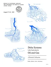
This classic publication is a syllabus published in conjunction with a Research Colloquium of the Bureau of Economic Geology, August 27-29,1969. It includes discussion notes, 168 maps and other text figures, and a list of 321 selected references pertaining to modern and ancient delta systems. The discussion notes are: Delta Systems and Deltaic Deposition, by A. J. Scott and W. L. Fisher.
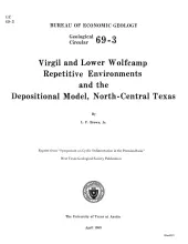
Virgil and lower Wolfcamp rocks on the Eastern Shelf in North-central Texas are composed of several intergradational depositional systems comprising 1,200 to 1,500 feet of off-lapping, predominantly terrigenous sediments.
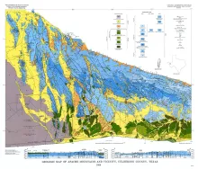
Geologic map that depicts surface geology of Swisher, Briscoe, Hall, and Childress Counties and parts of Randall, Armstrong, Donley, Collingsworth, Hale, Floyd, Motley, and Cottle Counties. This map was published as a memorial to William Fletcher Cummins, who pioneered in mapping West Texas geology and specialized in the study of Permian rocks of West Texas and New Mexico. These rocks are depicted in the eastern two-thirds of the Plainview Sheet.
![Texas Mining Laws Pertaining to State Public Lands [as of 1968]](/files/styles/medium/public/publication_covers/MM0033.jpg.webp?itok=rYQbRj6O)