
This folded transparent map is at the same scale as its corresponding Geologic Atlas of Texas (GAT) sheet and can be superimposed on it to compare gravity information with surface geology.
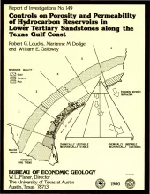
Examination of porosity and permeability (reservoir quality) data, as determined by whole core, acoustic log, and petrographic analyses of lower Tertiary sandstones along the Texas Gulf Coast, made it possible to delineate areas most favorable for development of hydrocarbon reservoirs. Deep (about 3,350 m [11,000 ft] or greater) Wilcox sandstones exhibit no systematic regional reservoir-quality trends. Along the lower and parts of the middle and upper Texas Gulf Coast, deep Wilcox sandstones are tight, but in other parts of the middle and upper Texas Gulf Coast, porosity exists at depth.
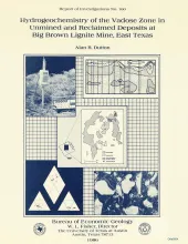
In the subsurface and at the outcrop, waters in argillaceous deposits of the Calvert Bluff Formation (lower Eocene, Wilcox Group) are brackish to saline. Samples of vadose water from the outcrop of argillaceous beds at Big Brown lignite mine in Freestone County, Texas, have chloride concentrations of as much as 3,500 mg/L and total dissolved solids of as much as 8,000 mg/L. The composition of brackish ground water was probably modified from Eocene seawater by sevenfold to ninefold dilution with rain water.
Oil and gas production in Texas peaked in 1972, but the state still contributed 28 percent of oil production and 33 percent of gas production in the United States in 1984. The outlook for future oil and gas supplies in Texas can best be defined by analyzing the trends of the past 10 to 15 years.
Numerous salt-emission areas exist within the Permian outcrop in the Rolling Plains of Texas and southwestern Oklahoma. Sodium chloride waters underlie the area at relatively shallow depths, discharge from salt springs and salt seeps, and greatly impair the quality of ground and surface waters. This study distinguishes between brine derived from dissolution of halite by fresh, locally recharged ground water in a shallow ground-water system and brine derived from deep-basin brine aquifers.