
Middle-upper Miocene depositional sequences of offshore Texas represent the last regionally significant influx of terrigenous elastic sediments into the western Gulf Coast Basin.
In the Palo Duro Basin, the Wolfcampian Series (lower Permian) overlies Pennsylvanian (primarily Virgilian) strata and underlies the Wichita Group (Leonardian). Tectonic activity from late Pennsylvanian through early Wolfcampian deposition included basement subsidence that resulted in localized basin development.
The interaction of geomorphic and ground-water processes has produced the Caprock Escarpmentthat bounds the eastern margin of the Southern High Plains in the Texas Panhandle. Spring sapping,slumping, and piping at the surface and salt dissolution in the subsurface are some of the many erosionalprocesses affecting the escarpment.Substantial thicknesses of bedded Permian salt (halite) have been dissolved from the Salado, SevenRivers, San Andres, and Glorieta Formations beneath the Caprock Escarpment and the Rolling Plains,east of the escarpment.
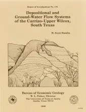
In the Rio Grande Embayment of South Texas, the Carrizo Formation (lower Eocene) consists of two sand-rich fluvial depositional systems that grade basinward into several deltaic complexes within the upper part of the Wilcox Group. Data from oil, gas, and water wells provide information on Carrizo fluvial and ground-water flow systems, and outcrop and core data help define component lithofacies.The bed-load channel system contains multistory, multilateral fluvial channel-fill sandstones deposited by broad, sand-rich, dominantly braided streams.
Damon Mound salt dome, located in Brazoria County, Texas, is a shallow diaper that has salt less than 600 ft (180 m) and cap rock less than 100 ft (30 m) below the surface. Oligocene through Pleistocene strata thin toward the diapir, and the occurrence of a coralline facies of the Oligocene Heterostegina limestone above the cap rock suggests seafloor relief over the diapir during late Oligocene time. Thickening of Miocene and Plio-Pleistocene strata peripheral to the dome suggests syndepositional salt flow from surrounding salt withdrawal subbasins.