
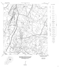
The first entry in the Guidebook Series details a field excursion to the Eastern Llano Region of Central Texas in 1958. Retrace the footsteps of Virgil Barnes and the other state geologists in attendance:
Stop 1. Honeycut Bend
Stop 2. High-calcium reef, Marble Falls area, Burnet County
Stop 3. Granite Mountain, Marble Falls area, Burnet County
Stop 4. Base of Cambrian, Slaughter Gap, Marble Falls area, Burnet County
Stop 5. Texas Construction Material Company...Burnet County
Optional Stop. Mormon Mill locatlity, Burnet County
Fourteen black-and-white geologic maps prepared in 1957 and 1959 and obtained from the Department of Geological Sciences, University of Texas, and sold by the Bureau of Economic Geology. Geology compiled by F. L. Whitney; drafted by S. Espey, W. M. Strong, or W. L. Brooks; edited by K. P. Young.
Fourteen maps are included:
MM0016-A-Austin, NE (Travis and Williamson Counties)
MM0016-B-Austin, SW (Hays and Travis Counties)
MM0016-C-Bastrop (Travis County section)
MM0016-D-Blanco, SE (Hays County)
The eastern margin of the High Plains in central western Texas affords particularly good opportunity for study of late Cenozoic geology. The topography of the area is dominated by the southernmost segment of the late Tertiary mantle of fluvial sediments, isolated from the central and northern High Plains by the valley of the Canadian River. The eastern escarpment presents many exposures and the canyons that extend into the plains contain, in addition, a nearly complete sequence of Pleistocene terraces and deposits.
Uranium was discovered near Tordilla Hill in Karnes County, south-central Texas, in the fall of 1954, in the upper part of the Jackson formation of late Eocene age. By July 1955, 14 uranium prospects were reported as far northeast as Fayette County, northeast of Karnes County, and southwest to Duval County, south Texas, over a distance of about 190 miles. Uranium minerals or radioactive rocks have been found in tuffaceous sand, silt, or bentonitic clay in at least seven different stratigraphic positions ranging in age from late Eocene to Pliocene.

In the Great Plains the succession of gross ecological conditions through Neogene and Quaternary time may be interpreted from the stratigraphy, geomorphological history, buried soils, and fossil mollusks and plants. A mild humid climate prevailed over a late-mature erosional topography in earliest Neogene. Progressive reduction of topographic relief and lowering of the regional water table, accompanied by an almost uniform drying of the climate, followed. Semiarid, rigorous conditions existed on the constructional plain, temporarily at erosional equilibrium, at the end of the Tertiary.