|
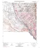
Geologic map of the Smeltertown quadrangle, Texas |
Collins, E.W. |
1996 |
Open-File Map |
|
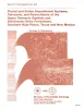
Fluvial and eolian depositional systems, paleosols, and paleoclimate of the Upper Cenozoic Ogallala and Blackwater Draw Formations, southern High Plains, Texas and New Mexico |
Gustavson, T.C. |
1996 |
Report of Investigations |
|
Annual Report of the Bureau of Economic Geology 1996 |
University of Texas at Austin, Bureau of Economic Geology |
1996 |
Annual Reports |
|
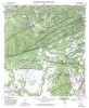
Geologic map of the Helotes quadrangle, Texas |
Collins, E.W. |
1995 |
Open-File Map |
|
Geologic map of the Comfort quadrangle, Texas |
Collins, E.W. |
1995 |
Open-File Map |
|
Geologic map of the San Geronimo Quadrangle, Texas |
Collins, E.W. |
1995 |
Open-File Map |
|
Geologic map of the Van Raub quadrangle, Texas |
Collins, E.W. |
1995 |
Open-File Map |
|
Geologic map of the Fort Bliss NE Quadrangle, Texas |
Collins, E.W. |
1995 |
Open-File Map |
|
Geologic map of the Jack Mountain Quadrangle, Texas |
Collins, E.W. |
1995 |
Open-File Map |
|
Production Optimization of Tide-Dominated Deltaic Reservoirs of the Lower Misoa Formation (Lower Eocene) LL-652 Area, Lagunillas Field, Lake Maracaibo, Venezuela |
Ambrose, W.A., Ferrer, E.R., Dutton, S.P., Wang, F.P., Padron, A., Carrasquel, W., Yeh, J.S., Tyler, Noel |
1995 |
Report of Investigations |
|
On Solid Ground: Memoirs of a Texas Geologist |
Barnes, V.E. |
1995 |
Selected Reports |
|
A 3-D seismic case history evaluating fluvially deposited thin-bed reservoirs in a gas-producing property |
Hardage, B.A., Levey, R.A., Pendleton, V.M., Simmons, J.L., Jr., Edson, R.D. |
1995 |
Geological Circular |
|
Geologic map of the Fort Bliss SE Quadrangle, Texas |
Collins, E.W. |
1995 |
Open-File Map |
|
Geologic map of the Ysleta quadrangle, Texas |
Collins, E.W., Raney, J.A. |
1995 |
Open-File Map |
|
Identification and assessment of remaining oil resources in the Frio fluvial-deltaic sandstone play, south Texas |
Holtz, M.H., McRae, L.E. |
1995 |
Report of Investigations |
|
Controls on reservoir heterogeneity in Permian shallow-water-platform carbonate reservoirs, Permian Basin: implications for improved recovery |
Ruppel, S.C., Kerans, Charles, Major, R.P., Holtz, M.H. |
1995 |
Geological Circular |
|
Geologic and Hydrologic Assessment of Natural Gas from Coal: Greater Green River, Piceance, Powder River, and Raton Basins, Western United States |
Tyler, Roger, Kaiser, W.R., Scott, A.R., Hamilton, D.S., Ambrose, W.A. |
1995 |
Report of Investigations |

|
Naturally Occurring Radioactive Materials (NORM) in Produced Water and Scale from Texas Oil, Gas, and Geothermal Wells |
Fisher, R.S. |
1995 |
Geological Circular |
|
Geologic map of the Medina Lake Quadrangle, Texas |
Collins, E.W. |
1995 |
Open-File Map |
|
Origin and development of playa basins, sources of recharge to the Ogallala aquifer, southern High Plains, Texas and New Mexico |
Gustavson, T.C., Holliday, V.T., Hovorka, S.D. |
1995 |
Report of Investigations |