|
GCAGS Transactions Volume 58 (2008) Houston |
|
2008 |
Gulf Coast Association of Geological Societies |
|
Annual Report of the Bureau of Economic Geology 2008 |
University of Texas at Austin, Bureau of Economic Geology |
2008 |
Annual Reports |
|
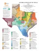
Industrial Minerals of Texas |
Kyle, J.R. |
2008 |
Thematic Maps |
|
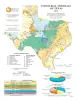
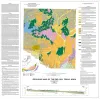
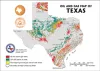
General Soil Map of Texas |
University of Texas at Austin, Bureau of Economic Geology |
2008 |
Thematic Maps |
|
Africa: Opportunity from Coast to Coast |
|
2008 |
Houston Geological Society |
|
Leaning Forward, A Memoir |
Fisher, W.L. |
2008 |
Udden Series |
|
Geologic map of the Del Rio, Texas, area |
Collins, E.W. |
2007 |
Miscellaneous Map |
|
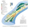
Geoenvironmental map of southwest Bolivar Peninsula, Bolivar and Flake quadrangles, Texas Gulf of Mexico Coast |
Tremblay, T.A., White, W.A., Waldinger, R.L., Collins, E.W. |
2007 |
Open-File Map |
|
Reimers Ranch and Westcave Preserve, Landscapes, Water, and Lower Cretaceous Stratigraphy of the Pedernales Watershed, Western Travis County, Texas |
Hunt, B.B., Woodruff, C.M., Jr., Collins, E.W. |
2007 |
Austin Geological Society |
|
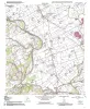
Geologic map of the Chances Store quadrangle, Texas |
Collins, E.W. |
2007 |
Open-File Map |
|
GCAGS Transactions Volume 57 (2007) Corpus Christi |
|
2007 |
Gulf Coast Association of Geological Societies |
|
Geologic map of the Goodwill quadrangle, Texas |
Collins, E.W. |
2007 |
Open-File Map |
|
Annual Report of the Bureau of Economic Geology 2007 |
University of Texas at Austin, Bureau of Economic Geology |
2007 |
Annual Reports |
|
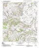
Geologic map of the Mumford quadrangle, Texas |
Collins, E.W. |
2007 |
Open-File Map |
|
Geologic map of the Tunis quadrangle, Texas |
Collins, E.W. |
2007 |
Open-File Map |
|
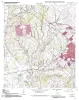
Geologic map of the Bryan West quadrangle, Texas |
Collins, E.W. |
2007 |
Open-File Map |
|
Reservoir Geology, Structural Architecture, and Sequence Stratigraphy of a Growth-Faulted Subbasin: Oligocene Lower Frio Formation, Red Fish Bay Area, South Texas Gulf Coast |
Hammes, Ursula, Loucks, R.G., Brown, L.F., Jr., Treviño, R.H., Montoya, Patricia, Remington, R.L. |
2007 |
Report of Investigations |
|
Geology of the Karnes Uranium District, Texas |
Cherepon, Alan J., Brandt, Jon E., Galloway, W.E. |
2007 |
Austin Geological Society |
|
Oil and Gas Map of Texas Postcard |
|
2006 |
Miscellaneous Map |
|
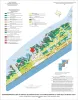
Geo-Environmental map of Central Galveston Island, Lake Como quadrangle, Texas |
Tremblay, T.A., Gibeaut, J.C., Waldinger, R.L., White, W.A., Collins, E.W. |
2006 |
Open-File Map |