Publication Details
Geolocation:
Get the Publication
$48.00
Abstract/Description:
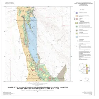
This six-sheet set of oversize colorful geologic maps and cross sections presents new interpretations on the outcrop pattern and complex structure within the Upper Cretaceous Del Rio, Buda, Boquillas, Pen, Aguja, Javelina, and Cretaceous-Tertiary Black Peaks Formations of Big Bend National Park. The maps show many of the popular areas for tourist (and field-trip) visitation within the park.
The geologic map set complements, and in some cases updates, other Bureau publications about the geology of Big Bend National Park, such as GB0007 (The Big Bend of the Rio Grande, a Guide to the Rocks, Landscape, Geologic History, and Settlers of the Area of Big Bend National Park), GQ0054 (Structural Geology of Sierra del Carmen, Trans-Pecos, Texas), MM0046 (Geologic Map of the Glenn Spring Quadrangle, Big Bend National Park, Texas), and MM0048 (Geologic Map of Mariscal Mountain, Big Bend National Park, Texas).