Publication Details
Geolocation:
Get the Publication
$15.50
Abstract/Description:
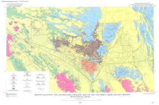
The Van Horn-Sierra Blanca region lies athwart part of the boundary between two contrasting geologic provinces. The contrast between these two provinces, splendidly displayed by Holocene landforms in the present map area, has a history that dates back to at least Late Precambrian time. This remarkable contrast led R. T. Hill (1902) to suggest the possibility of a transcontinental fracture zone passing near Van Horn and along the boundary of the provinces. Later workers called Hill's frac ture zone the Texas lineament (Ransome, 1915) or the Texas direction of wrench faulting (Moody and Hill, 1956). Where it is exposed in the region, the Rim Rock fault (fig. 1) seems to form part of the boundary between the provinces. Numerous workers have suggested a long-enduring history of strike-slip movement along the Hillside fault (fig. 1). The Van Horn-Sierra Blanca region has been mapped in detail geologically, but because nearly half of the total area of the region is covered by late Cenozoic basin-fill and because subsurface control is sparse, it has not been possible to understand the region in detail in three dimensions. This report summarizes the methods and results of a ground magnetometer and gravimeter survey undertaken in an attempt to obtain a clearer understanding of the tectonic history of the region and of the structural significance of the Hillside and Rim Rock faults.