Publication Details
Publication Year
2023
Map Scale
1:1000000
Publication Code
OFM0278
Series
Open-File Map
Publisher
Geolocation:
Get the Publication
Free download:
Available to Purchase:
$10.00
The print version of this product is currently out of stock. Most items can be printed on-demand, please contact us to order: pubsales@beg.utexas.edu
Abstract/Description:
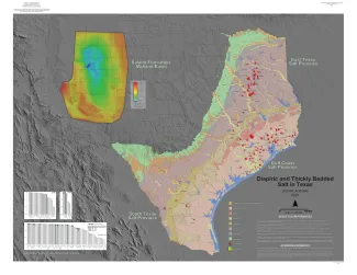
This 1:1,000,000 scale map shows salt dome locations and salt bed structure in onshore Texas. The GeMS GIS database contains structure contours for both domes and bedded salt. Source data include structure contour maps between scales of 1:2,000 and 1:24,000 published between 1925 and 2021. The source map contours were interpreted from well data and geophysical measurements including seismic, gravimetric, and magnetic. Contour intervals vary depending on source data; all represent salt structure elevations relative to mean sea level (MSL).