Publications in Uvalde
| Title | Publication Year Sort ascending | Abstract | Author | Series | Publisher | |
|---|---|---|---|---|---|---|
|
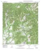
Geologic map of the Seco Pass Quadrangle, Texas | 1999 | Collins, E.W. | Open-File Map | Bureau of Economic Geology | |
|
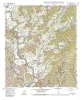
Geologic map of the Magers Crossing Quadrangle, Texas | 1999 | Collins, E.W. | Open-File Map | Bureau of Economic Geology | |
|
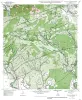
Geologic map of the Comanche Waterhole quadrangle, Texas | 1999 | Collins, E.W. | Open-File Map | Bureau of Economic Geology | |
|
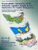
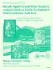
Permeability structure of the Edwards aquifer, south Texas -- implications for aquifer management | 1998 | This report describes the three-dimensional distribution of hydraulic conductivity in the Edwards aquifer from Kinney to Comal Counties, Texas. |
Hovorka, S.D., Mace, R.E., Collins, E.W. | Report of Investigations | Bureau of Economic Geology |
|
Structure Map of the San Antonio Segment of the Edwards Aquifer and Balcones Fault Zone, South-Central Texas: Structural Framework of a Major Limestone Aquifer: Kinney, Uvalde, Medina, Bexar, Comal, and Hays Counties | 1997 | Collins, E.W., Hovorka, S.D. | Miscellaneous Map | Bureau of Economic Geology | |
|
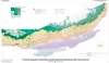
Edwards aquifer ground-water resources: geologic controls on porosity development in platform carbonates, south Texas | 1996 | Focusing on the highly developed Edwards aquifer, which supplies water for a large area of south-central Texas, this report presents a three-dimensional model of the porosity distribution in the aquifer, which quantifies the spatial distribution of water resources and provides information that ca |
Hovorka, S.D., Dutton, A.R., Ruppel, S.C., Yeh, J.S. | Report of Investigations | Bureau of Economic Geology |
|
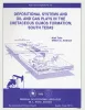
Depositional systems and oil and gas plays in the Cretaceous Olmos Formation, south Texas | 1986 | The Upper Cretaceous Olmos Formation in South Texas continues to be an active exploration target 60 years after oil was first discovered in this clastic assemblage. The shallow, oil-bearing formation was deposited on a broad, wave-influenced shelf. Sand accumulated in two depocenters. |
Tyler, Noel, Ambrose, W.A. | Report of Investigations | Bureau of Economic Geology |
|
Depositional and diagenetic history of the Sligo and Hosston Formations(Lower Cretaceous) in south Texas | 1981 | The Sligo and Hosston Formations of Aptian age occur over thousands of square miles in the subsurface of South Texas. |
Bebout, D.G., Budd, D.A., Schatzinger, R.A. | Report of Investigations | Bureau of Economic Geology |

|
Geologic Atlas of Texas, Del Rio sheet | 1977 | Geologic map that depicts surface geology of Kinney County and parts of Terrell, Val Verde, Edwards, Real, Uvalde, and Maverick Counties, Texas. |
Barnes, V.E., Waechter, N.B., Pinkley, G.R., Martin, R.G., Wyeth, J.C., Knupke, J.A., Sulik, J.F., Ellis, W.G. | Geologic Atlas of Texas | Bureau of Economic Geology |
|
Regional distribution of fractures in the southern Edwards Plateau and their relationship to tectonics and caves | 1977 | In order to better understand the control exerted by fractures on the recharge and production zones of limestone aquifers, the authors delineated surficial fracture zones in the southern Edwards Plateau, Texas. Lineations were marked on nearly 200 mosaics scale of 1:24,000. |
Wermund, E.G., Cepeda, J.C., Luttrell, P.E. | Geological Circular | Bureau of Economic Geology |