Publications in Sherman
| Title | Publication Year Sort ascending | Abstract | Author | Series | Publisher | |
|---|---|---|---|---|---|---|
|
Geologic Significance of Remotely Sensed Physiographic Features of the Texas Panhandle and Adjacent Regions | 1990 | Remotely sensed features such as linear drainages, escarpments, ridges, and aligned playas have been identified on Landsat imagery (scale 1:250,000) of the Texas Panhandle and adjacent regions to allow comparison of these features with detailed regional and site-specific geologic data. |
Collins, E.W. | Geological Circular | Bureau of Economic Geology |
|
Tectonic structures of the Palo Duro basin, Texas panhandle | 1989 | The Palo Duro Basin is a broad structural low in the southern Texas Panhandle that formed as a result of nearly continuous Pennsylvanian and Permian subsidence. True complexity of this basin is unknown because of the sparsity of structural information. |
Budnik, R.T. | Report of Investigations | Bureau of Economic Geology |
|
Bouguer gravity Atlas of Texas, Dalhart sheet | 1986 | This folded transparent map is at the same scale as its corresponding Geologic Atlas of Texas (GAT) sheet and can be superimposed on it to compare gravity information with surface geology. |
Keller, G.R., Aiken, C.L.V. | Bouguer Gravity Atlas of Texas | Bureau of Economic Geology |
|
Bouguer gravity Atlas of Texas, Perryton sheet | 1986 | This folded transparent map is at the same scale as its corresponding Geologic Atlas of Texas (GAT) sheet and can be superimposed on it to compare gravity information with surface geology. |
Keller, G.R., Aiken, C.L.V. | Bouguer Gravity Atlas of Texas | Bureau of Economic Geology |
|
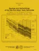
Cyclicity in the Middle Permian San Andres Formation, Palo Duro Basin, Texas panhandle | 1986 | The San Andres Formation in the Palo Duro Basin is a middle Permian carbonate-evaporite sequence situated between two red-bed units, the underlying Glorieta and the overlying undifferentiated Queen-Grayburg sequences. |
Fracasso, M.A., Hovorka, S.D. | Report of Investigations | Bureau of Economic Geology |
|
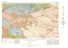
Geologic Atlas of Texas, Dalhart sheet | 1984 | Oversize color geologic map that depicts the surface geology of Dallam County and parts of Sherman, Moore, and Hartley Counties, Texas. The 6-page booklet indicates geologic formations, abbreviations, and ages. |
Barnes, V.E., Eifler, G.K., Fay, R.O., Trauger, F.D., Lappala E.G., Johnson, G.S., Hood, H.C., Stagges, D | Geologic Atlas of Texas | Bureau of Economic Geology |
|
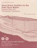
Deep brine aquifers in the Palo Duro basin: regional flow and geochemical constraints | 1983 | Geologic characterization of evaporite deposits as potential host rocks for burial of radioactive waste must include hydrogeologic investigations at both local and regional scales. |
Bassett, R.L., Bentley, M.E., Duncan, E.A. | Report of Investigations | Bureau of Economic Geology |
|
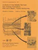
Geology and geohydrology of the Palo Duro basin, Texas panhandle -- a report on the progress of nuclear waste isolation feasibility studies (1981), annual report for period October 1, 1980 - September 30, 1981 | 1982 | Integrated study of the basin structure, tectonic history, rock physics, physical stratigraphy, hydrogeology, geochemistry, natural resources, and geomorphology of the Palo Duro and Dalhart Basins in the Texas Panhandle is part of a national evaluation of ancient salt basins as potential sites fo |
Gustavson, T.C., Bassett, R.L., Budnik, R.T., Finley, A.C., Goldstein, A.G., McGowen, J.H., Roedder, E., Ruppel, S.C. | Geological Circular | Bureau of Economic Geology |
|
Coastal evaporite and tidal-flat sediments of the upper Clear Fork and Glorieta Formations, Texas panhandle | 1982 | Red beds, evaporites, and carbonates of the upper Clear Fork and Glorieta Formations (Permian) of the Texas Panhandle form an association of facies deposited in nearshore and supratidal environments along an arid coastline. |
Presley, M.W., McGillis, K.A., Mikan, F.M., Gray, C.A. | Report of Investigations | Bureau of Economic Geology |
|
Petroleum potential of the Palo Duro basin, Texas panhandle | 1982 | The Palo Duro Basin seemingly has all the elements necessary for hydrocarbon generation and accumulation: reservoirs, traps, source rocks, and sufficient thermal maturity. Porous facies in pre-Pennsylvanian, Pennsylvanian, and Permian strata are potential hydrocarbon reservoirs. |
Dutton, S.P., Goldstein, A.G., Ruppel, S.C. | Report of Investigations | Bureau of Economic Geology |