Publications in Jefferson
| Title | Publication Year Sort ascending | Abstract | Author | Series | Publisher | |
|---|---|---|---|---|---|---|
|
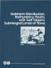
Sediment distribution, bathymetry, faults, and salt diapirs, submerged lands of Texas | 1979 | The State-owned submerged lands of Texas encompass nearly 6,000 square miles (15,540 km²) and extend from Mexico to Louisiana. The area includes the bays, estuaries, and lagoons, as well as the inner continental shelf 10.3 miles (16.6 km) seaward of the Gulf shoreline (fig. 1). |
McGowen, J.H., Morton, R.A. | Selected Reports | Bureau of Economic Geology |
|
Historical Shoreline Changes and Their Causes, Texas Gulf Coast | 1977 | Sequential shoreline monitoring, using vintage chans and aerial photographs, documents temporal and spatial variations in historical Gulf shoreline changes. |
Morton, R.A. | Geological Circular | Bureau of Economic Geology |
|
Geothermal Resources of the Texas Gulf Coast: Environmental Concerns Arising from the Production and Disposal of Geothermal Waters | 1976 | Disposal and temporary surface storage of spent geothermal fluids and surface subsidence and faulting are the major environmental problems that could arise from geopressured geothermal water production. |
Gustavson, T.C., Kreitler, C.W. | Geological Circular | Bureau of Economic Geology |
|
Shoreline changes between Sabine Pass and Bolivar Roads -- an analysis of historical changes of the Texas Gulf shoreline | 1975 | Historical monitoring between Sabine Pass and Bolivar Roads records the nature and magnitude of changes in position of the shoreline and vegetation line and provides insight into the factors affecting those changes. |
Morton, R.A. | Geological Circular | Bureau of Economic Geology |
|
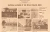
Natural hazards of the Texas coastal zone | 1974 | The Texas Coastal Zone is marked by diversity in geography, resources, climate, and industry. |
Brown, L.F., Jr., Morton, R.A., McGowen, J.H., Kreitler, C.W., Fisher, W.L. | Selected Reports | Bureau of Economic Geology |

|
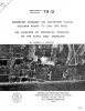
Depositional-Episodes: Their Relationship to the Quaternary Stratigraphic Framework in the Northwestern Portion of the Gulf Basin | 1974 | The stratigraphic record yields evidence that each episode of clastic silicate deposition has been of limited duration and that each has been preceded and followed by a significant hiatus. |
Frazier, D.E. | Geological Circular | Bureau of Economic Geology |
|
Shoreline changes on Galveston Island (Bolivar Roads to San Luis Pass) -- an analysis of historical changes of the Texas Gulf shoreline | 1974 | Historical monitoring along Galveston Island records the type and magnitude of changes in position of the shoreline and vegetation line and provides insight into the factors affecting those changes. |
Morton, R.A. | Geological Circular | Bureau of Economic Geology |
|
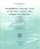
Environmental geologic Atlas of the Texas coastal zone -- Beaumont-Port Arthur area | 1973 | The Texas Coastal Zone is marked by diversity in geography, resources, climate, and industry. |
Fisher, W.L., Brown, L.F., Jr., McGowen, J.H., Groat, C.G. | Environmental Geologic Atlas of the Texas Coastal Zone | Bureau of Economic Geology |

|
Evaluation of Sanitary Landfill Sites, Texas Coastal Zone: Geologic and Engineering Criteria | 1972 | Basic geologic, hydrologic and engineering criteria on which selection of sanitary landfill sites should be based include (1) thickness, excavation characteristics, permeability, solution-holding capacity, and reactivity of host and cover materials; (2) hydrologic properties including depth to wa |
Brown, L.F., Jr., Fisher, W.L., Malina, J.F. | Geological Circular | Bureau of Economic Geology |

|
Resource Capability Units: Their Utility in Land- and Water-Use Management with Examples from the Texas Coastal Zone | 1971 | A resource capability unit is an environmental entity--land, water, area of active process, or biota--defined in terms of the nature, degree of activity, or use it can sustain without losing an acceptable level of environmental quality. |
Brown, L.F., Jr., Fisher, W.L., Erxleben, A.W., McGowen, J.H. | Geological Circular | Bureau of Economic Geology |