Publications in Crockett
| Title | Publication Year Sort ascending | Abstract | Author | Series | Publisher | |
|---|---|---|---|---|---|---|
|
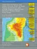
Upper Pennsylvanian and Lower Permian Shelf-to-Basin Facies Architecture and Trends, Eastern Shelf of the Southern Midland Basin, West Texas | 2017 | Our study documents the shelf, shelf-edge, slope, and basin-floor depositional facies characteristics, stratigraphic variations, and sedimentation trends of the Missourian Canyon Group and Virgilian–Wolfcampian Cisco Group across the southern Eastern Shelf and the adjacent Midland Basin. |
Hentz, T.F., Ambrose, W.A., Hamlin, H.S. | Report of Investigations | Bureau of Economic Geology |
|
Regional stratigraphic cross sections, Comanche Cretaceous (Fredericksburg - Washita Division), Edwards and Stockton plateaus, West Texas: interpretation of sedimentary facies, depositional cycles, and tectonics | 2000 | Six interlocking regional stratigraphic cross sections of Lower Cretaceous strata (middle Albian-lower Cenomanian) of the Edwards and Stockton Plateaus of West Texas illustrate the vertical and lateral extent of lithostratigraphic units and distribution of facies and facies tracts. |
Smith, C.I., Brown, J.B., Lozo, F.E. | Cross Sections | Bureau of Economic Geology |
|
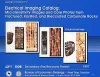
Electrical Imaging Catalog: Microresistivity Images and Core Photos from Fractured, Karsted, and Brecciated Carbonates | 1997 | Electrical images in boreholes are becoming increasingly important in interpreting the rock record. |
Hammes, Ursula | Geological Circular | Bureau of Economic Geology |
|
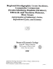
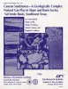
Canyon sandstones -- a geologically complex natural gas play in slope and basin facies, Val Verde basin, southwest Texas | 1995 | Canyon sandstones form a prolific low-permeability gas play in the Val Verde Basin of southwest Texas. Exploration and development activity is at a high level, but little published information on Canyon geology is available. |
Hamlin, H.S., Clift, S.J., Dutton, S.P., Hentz, T.F., Laubach, S.E. | Report of Investigations | Bureau of Economic Geology |
|
Stratigraphic analysis of the Upper Devonian Woodford Formation, Permian Basin, West Texas and southeastern New Mexico | 1991 | The Upper Devonian Woodford Formation is an organic-rich petroleum source rock that extends throughout West Texas and southeastern New Mexico and currently is generating oil or gas in the subsurface. |
Comer, J.B. | Report of Investigations | Bureau of Economic Geology |
|
Integrated characterization of Permian Basin reservoirs, university lands, West Texas: targeting the remaining resource for advanced oil recovery | 1991 | Unrecovered mobile oil is oil that is movable at reservoir conditions but is prevented from migrating to existing we1 l bores because of geologic complexities or heterogeneities. |
Tyler, Noel, Bebout, D.G., Garrett, C.M., Jr., Guevara, E.H., Hocott, C.R., Holtz, M.H., Hovorka, S.D., Kerans, Charles | Report of Investigations | Bureau of Economic Geology |
|
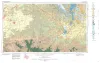
Geologic Atlas of Texas, Sonora sheet | 1981 | Geologic map that depicts the surface geology of Sutton County and parts of Terrell, Crockett, Val Verde, Edwards, Kimble, Menard, Schleicher, and Pecos Counties. |
Barnes, V.E., McKalips, D.G., Cities Service Petroleum Co., Geophoto Services Inc., Stump, R.W., Brown, J.B., Pearson, B.T., Volkmann, R.G. | Geologic Atlas of Texas | Bureau of Economic Geology |
|
Depositional framework of the Lower Dockum Group (Triassic), Texas panhandle | 1979 | The Upper Triassic Dockum Group of Texas and New Mexico is composed of 200 to 2,000 feet of complexly interrelated terrigenous clastic facies ranging from mudstone to conglomerate. |
McGowen, J.H., Granata, G.E., Seni, S.J. | Report of Investigations | Bureau of Economic Geology |

|
Geologic Atlas of Texas, Pecos sheet | 1976 | Geologic map that depicts the surface geology of Loving, Crane, and Ward Counties and parts of Ector, Midland, Upton, Pecos, Reeves, Crockett, and Winkler Counties, Texas. The 5-page booklet indicates geologic formations, abbreviations, and ages. |
Barnes, V.E., Eifler, G.K., Shell Oil Co., Cities Service Petroleum Co., Brown, J.B. | Geologic Atlas of Texas | Bureau of Economic Geology |
|
Geologic Atlas of Texas, San Angelo sheet | 1974 | Geologic map that depicts the surface geology of Tom Green, Irion, and Reagan Counties and parts of Midland, Glasscock, Sterling, Coke, Runnels, Concho, Menard, Schleicher, Crockett, and Upton Counties, Texas. |
Barnes, V.E., Eifler, G.K., Shell Oil Co., Southern Minerals Corp., Humble Oil and Refining Co., Cannon, Joe, Brown, W.J., Swartz, G.D. | Geologic Atlas of Texas | Bureau of Economic Geology |