Publications in Childress
| Title | Publication Year Sort ascending | Abstract | Author | Series | Publisher | |
|---|---|---|---|---|---|---|
|
Mississippian conodonts from the southern Texas panhandle | 1986 | Ruppel, S.C., Lemmer, T.M. | Geological Circular | Bureau of Economic Geology | |

|
Bouguer gravity Atlas of Texas, Plainview sheet | 1986 | This folded transparent map is at the same scale as its corresponding Geologic Atlas of Texas (GAT) sheet and can be superimposed on it to compare gravity information with surface geology. |
Keller, G.R., Aiken, C.L.V. | Bouguer Gravity Atlas of Texas | Bureau of Economic Geology |
|
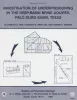
Investigation of underpressuring in the deep-basin brine aquifer, Palo Duro basin, Texas | 1985 | Although plots of pressure versus depth are useful for understanding the hydrodynamics of ground-water systems, they can be difficult to interpret. |
Orr, E.D., Kreitler, C.W., Senger, R.K. | Geological Circular | Bureau of Economic Geology |

|
Deep brine aquifers in the Palo Duro basin: regional flow and geochemical constraints | 1983 | Geologic characterization of evaporite deposits as potential host rocks for burial of radioactive waste must include hydrogeologic investigations at both local and regional scales. |
Bassett, R.L., Bentley, M.E., Duncan, E.A. | Report of Investigations | Bureau of Economic Geology |

|
Coastal evaporite and tidal-flat sediments of the upper Clear Fork and Glorieta Formations, Texas panhandle | 1982 | Red beds, evaporites, and carbonates of the upper Clear Fork and Glorieta Formations (Permian) of the Texas Panhandle form an association of facies deposited in nearshore and supratidal environments along an arid coastline. |
Presley, M.W., McGillis, K.A., Mikan, F.M., Gray, C.A. | Report of Investigations | Bureau of Economic Geology |

|
San Andreas carbonates in the Texas panhandle: sedimentation and diagenesis associated with magnesium-calcium-chloride brines | 1982 | The San Andres evaporitic sequence in the Palo Duro Basin comprises several thick carbonate units in its lower part and many thin units in its upperpart. To the south, across the Northern Shelf of the Midland Basin, evaporites pinch out and carbonates predominate. |
Bein, Amos, Land, L.S. | Report of Investigations | Bureau of Economic Geology |
|
Petroleum potential of the Palo Duro basin, Texas panhandle | 1982 | The Palo Duro Basin seemingly has all the elements necessary for hydrocarbon generation and accumulation: reservoirs, traps, source rocks, and sufficient thermal maturity. Porous facies in pre-Pennsylvanian, Pennsylvanian, and Permian strata are potential hydrocarbon reservoirs. |
Dutton, S.P., Goldstein, A.G., Ruppel, S.C. | Report of Investigations | Bureau of Economic Geology |
|
Geology and geohydrology of the Palo Duro basin, Texas panhandle -- a report on the progress of nuclear waste isolation feasibility studies (1981), annual report for period October 1, 1980 - September 30, 1981 | 1982 | Integrated study of the basin structure, tectonic history, rock physics, physical stratigraphy, hydrogeology, geochemistry, natural resources, and geomorphology of the Palo Duro and Dalhart Basins in the Texas Panhandle is part of a national evaluation of ancient salt basins as potential sites fo |
Gustavson, T.C., Bassett, R.L., Budnik, R.T., Finley, A.C., Goldstein, A.G., McGowen, J.H., Roedder, E., Ruppel, S.C. | Geological Circular | Bureau of Economic Geology |
|
Impact of evaporite dissolution and collapse on highways and other cultural features in the Texas panhandle and eastern New Mexico | 1981 | Geological investigations in the Texas Panhandle and eastern New Mexico indicate that regional subsurface dissolution of Permian evaporites has occurred and is an ongoing process. |
Simpkins, W.W., Gustavson, T.C., Alhades, A.B., Hoadley, A.D. | Geological Circular | Bureau of Economic Geology |

|
Regional cross sections of the Texas panhandle: Precambrian to mid-Permian | 1981 | The Texas Panhandle traditionally has been an important source of mineral resources, especially petroleum, and resources will continue to contribute heavily to the economy of the area. The seven cross sections of this report synthesize the subsurface geology of the region. |
Handford, C.R., Dutton, S.P., Fredericks, P.E. | Cross Sections | Bureau of Economic Geology |