Publications in Chambers
| Title | Publication Year Sort ascending | Abstract | Author | Series | Publisher | |
|---|---|---|---|---|---|---|

|
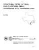
Structural cross sections, Plio-Pleistocene series, southeastern Texas | 1989 | These cross sections illustrate the regional structure and stratigraphy beneath the Texas continental shelf . |
Morton, R.A., Jirik, L.A. | Cross Sections | Bureau of Economic Geology |
|
Hydrogeology of Barbers Hill salt dome, Texas coastal plain | 1988 | Barbers Hill salt dome, located in the Texas Coastal Plain near Houston, has a long history of resource exploitation, including oil and brine production, storage of hydrocarbons in solution-mined caverns within the salt stock, and disposal of brine into the cap rock. |
Hamlin, H.S., Smith, D.A., Akhter, M.S. | Report of Investigations | Bureau of Economic Geology |
|
Submerged lands of Texas, Beaumont - Port Arthur area: sediments, geochemistry, benthic macroinvertebrates, and associated wetlands | 1987 | The State-owned submerged lands of Texas encompass almost 6,000 mi2 (15,540 km2). They lie below waters of the bay-estuary-lagoon system and the Gulf of Mexico and extend 10.3 mi (16.6 km) seaward from the Gulf shoreline (fig. 1). |
White, W.A., Calnan, T.R., Morton, R.A., Kimble, R.S., Littleton, T.G., McGowen, J.H., Nance, H.S. | Submerged Lands of Texas | Bureau of Economic Geology |
|
Historical shoreline changes in Trinity, Galveston, West, and East Bays, Texas Gulf coast | 1986 | Changes in shoreline position occurring for more than a century provide estimates of the relative stability of shorelines and, along the Texas coast, allow comparisons of shoreline changes before and after human modifications became significant. |
Paine, J.G., Morton, R.A. | Geological Circular | Bureau of Economic Geology |
|
Submerged lands of Texas, Galveston - Houston area: sediments, geochemistry, benthic macroinvertebrates, and associated wetlands | 1985 | The State-owned submerged lands of Texas encompass almost 6,000 mi2 (15,540 km2). They lie below waters of the bay-estuary-lagoon system and the Gulf of Mexico and extend 10.3 mi (16.6 km) seaward from the Gulf shoreline (fig. 1). |
White, W.A., Calnan, T.R., Morton, R.A., Kimble, R.S., Littleton, T.G., McGowen, J.H., Nance, H.S., Schmedes, K.E. | Submerged Lands of Texas | Bureau of Economic Geology |
|
Structural cross sections, Miocene series, Texas continental shelf | 1985 | These cross sections numerically correspond to previously published onshore cross sections (CS0002--Dodge and Posey, 1981) and extend those sections across the continental shelf into the Miocene, a recent target of renewed petroleum exploration. |
Morton, R.A., Jirik, L.A., Foote, R.Q. | Cross Sections | Bureau of Economic Geology |

|
Structural cross sections, Tertiary formations, Texas Gulf Coast | 1981 | The publication comprises 24 structural dip cross sections, spaced 15 to 20 mi apart along the Texas coast, and 4 structural strike cross sections. Dip sections extend from near the Wilcox outcrop to the coastline. |
Dodge, M.M., Posey, J.S. | Cross Sections | Bureau of Economic Geology |
|
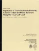
Importance of Secondary Leached Porosity in Lower Tertiary Sandstone Reservoirs along the Texas Gulf Coast | 1980 | Secondary leached porosity is common to dominant in near surface to deep subsurface lower Tertiary sandstone reservoirs along the Texas Gulf Coast. This secondary porosity is in the form of leached feldspar grains, volcanic rock fragments, carbonate cements, and carbonate-replaced grains. |
Loucks, R.G., Dodge, M.M., Galloway, W.E. | Geological Circular | Bureau of Economic Geology |
|
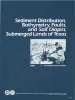
Sediment distribution, bathymetry, faults, and salt diapirs, submerged lands of Texas | 1979 | The State-owned submerged lands of Texas encompass nearly 6,000 square miles (15,540 km²) and extend from Mexico to Louisiana. The area includes the bays, estuaries, and lagoons, as well as the inner continental shelf 10.3 miles (16.6 km) seaward of the Gulf shoreline (fig. 1). |
McGowen, J.H., Morton, R.A. | Selected Reports | Bureau of Economic Geology |
|
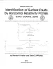
Identification of surface faults by horizontal resistivity profiles, Texas coastal zone | 1978 | The land surface in the Texas Coastal Zone is interlaced with active and potentially active surface faults. They are subtle features which are difficult to identify until they have caused damage to manmade structures. To date (1978), significant damage has resulted. |
Kreitler, C.W., McKalips, D.G. | Geological Circular | Bureau of Economic Geology |