|
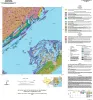
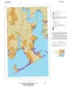
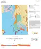
Geologic map of the Mesquite Bay area, Texas Gulf Coast |
2025 |
|
Paine, J.G., Caudle, T.L., Grunau, B.A., Morris, J.N. |
Open-File Map |
Bureau of Economic Geology |
|
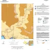
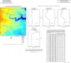
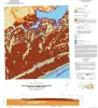
Geologic map of the Taft area, Texas Gulf Coast |
2025 |
|
Paine, J.G., Morris, J.N., Grunau, B.A. |
Open-File Map |
Bureau of Economic Geology |
|
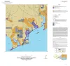
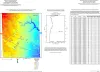
Geologic map of the Turtle Bay quadrangle, Texas Gulf of Mexico coast |
2021 |
|
Paine, J.G., Costard, L. |
Open-File Map |
Bureau of Economic Geology |
|
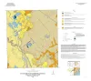
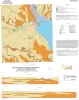
Geologic map of the Bloomington quadrangle, Texas Gulf of Mexico coast |
2020 |
|
Paine, J.G., Costard, L. |
Open-File Map |
Bureau of Economic Geology |
|
Geologic map of the Olivia and part of the Keller Bay quadrangles, Texas Gulf of Mexico coast |
2020 |
|
Paine, J.G., Costard, L. |
Open-File Map |
Bureau of Economic Geology |
|
Geologic map of the Placedo quadrangle, Texas Gulf of Mexico coast |
2019 |
|
Paine, J.G., Costard, L. |
Open-File Map |
Bureau of Economic Geology |
|
Geologic map of the Port Lavaca West quadrangle, Texas Gulf of Mexico coast |
2019 |
|
Paine, J.G., Costard, L. |
Open-File Map |
Bureau of Economic Geology |
|
Geologic map of the Kamey quadrangle, Texas Gulf of Mexico Coast |
2018 |
|
Paine, J.G., Collins, E.W., Costard, L. |
Open-File Map |
Bureau of Economic Geology |
|
Geologic map of the Point Comfort quadrangle, Texas Gulf of Mexico Coast |
2018 |
|
Paine, J.G., Collins, E.W., Costard, L. |
Open-File Map |
Bureau of Economic Geology |
|
Geologic Map of the Seadrift NE Quadrangle, Texas Gulf of Mexico Coast |
2017 |
|
Paine, J.G., Collins, E.W. |
Open-File Map |
Bureau of Economic Geology |