Publications in Brazoria
| Title | Publication Year Sort ascending | Abstract | Author | Series | Publisher | |
|---|---|---|---|---|---|---|
|
Depositional Systems and Controls on Reservoir Quality (Determined from Core Data) in Deeply Buried Tertiary Strata in the Texas-Louisiana Gulf of Mexico | 2013 | A study of the deeply buried (>10,000 ft [>3,050 m]) Tertiary section in the Gulf of Mexico, which makes use of whole cores from 12 wells in Louisiana and Texas, provides a framework for interpreting depositional origin and demonstrates that relative position within the sequence-stratigraph |
Ambrose, W.A., Loucks, R.G., Dutton, S.P. | Report of Investigations | Bureau of Economic Geology |
|
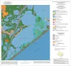
Geoenvironmental map of the Christmas Point quadrangle, Texas | 2004 | Tremblay, T.A., White, W.A., Waldinger, R.L., Collins, E.W. | Open-File Map | Bureau of Economic Geology | |
|
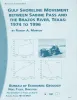
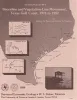
Gulf shoreline movement between Sabine Pass and the Brazos River, Texas: 1974 to 1996 | 1997 | Changes in shoreline position along the southeastern Texas Gulf coast between 1974 and 1996 were documented by conducting a kinematic real-time differential global positioning system (DGPS) field survey in 1996 and comparing that shoreline with other shorelines archived in a geographic informatio |
Morton, R.A. | Geological Circular | Bureau of Economic Geology |
|
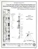
Core and Log Analyses of Depositional Systems and Reservoir Properties ... in Frio, Vicksburg, and Wilcox Sandstones | 1992 | The Gas Research Institute, U.S. Department of Energy, and the State of Texas cooperated in joint-venture research to evaluate the infield reserve growth potential of mature gas fields containing conventional reservoirs. |
Levey, R.A., Grigsby, J.D. | Geological Circular | Bureau of Economic Geology |
|
Shoreline and vegetation-line movement, Texas Gulf coast, 1974 to 1982 | 1989 | The purposes of this study were (1) to quantify recent (1974 to 1982) movement of Texas shorelines and vegetation lines by analysis of aerial photographs; (2) to place this movement in historical (pre-1974) context; and (3) to examine the influence of environmental variables such as storms, sea l |
Paine, J.G., Morton, R.A. | Geological Circular | Bureau of Economic Geology |
|
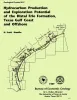
Hydrocarbon production and exploration potential of the distal Frio Formation, Texas Gulf coast and offshore | 1989 | Along the Texas Gulf shoreline and offshore, the distal margin of the Frio Formation is a deep hydrocarbon province that is underexplored relative to the onshore Frio. |
Hamlin, H.S. | Geological Circular | Bureau of Economic Geology |
|
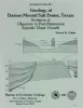
Geology of Damon Mound salt dome, Texas: evidence of Oligocene to post-Pleistocene episodic diapir growth | 1988 | Damon Mound salt dome, located in Brazoria County, Texas, is a shallow diaper that has salt less than 600 ft (180 m) and cap rock less than 100 ft (30 m) below the surface. |
Collins, E.W. | Geological Circular | Bureau of Economic Geology |
|
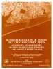
Submerged lands of Texas, Bay City - Freeport area: sediments, geochemistry, benthic macroinvertebrates, and associated wetlands | 1988 | The State-owned submerged lands of Texas encompass almost 6,000 mi2 (15,540 km2). They lie below waters of the bay-estuary-lagoon system and the Gulf of Mexico and extend 10.3 mi (16.6 km) seaward from the Gulf shoreline (fig. 1). |
White, W.A., Calnan, T.R., Morton, R.A., Kimble, R.S., Littleton, T.G., McGowen, J.H., Nance, H.S. | Submerged Lands of Texas | Bureau of Economic Geology |
|
Historical shoreline changes in Trinity, Galveston, West, and East Bays, Texas Gulf coast | 1986 | Changes in shoreline position occurring for more than a century provide estimates of the relative stability of shorelines and, along the Texas coast, allow comparisons of shoreline changes before and after human modifications became significant. |
Paine, J.G., Morton, R.A. | Geological Circular | Bureau of Economic Geology |

|
Structural cross sections, Miocene series, Texas continental shelf | 1985 | These cross sections numerically correspond to previously published onshore cross sections (CS0002--Dodge and Posey, 1981) and extend those sections across the continental shelf into the Miocene, a recent target of renewed petroleum exploration. |
Morton, R.A., Jirik, L.A., Foote, R.Q. | Cross Sections | Bureau of Economic Geology |