Publications in Bastrop
| Title | Publication Year Sort ascending | Abstract | Author | Series | Publisher | |
|---|---|---|---|---|---|---|
|
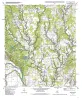
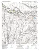
Geologic map of the Winchester quadrangle, Texas | 2001 | Collins, E.W. | Open-File Map | Bureau of Economic Geology | |
|
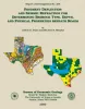
Pavement Deflection and Seismic Refraction for Determining Bedrock Type, Depth, and Physical Properties beneath Roads | 2000 | We examined the relationship between three data types--geologic maps, measurements of pavement deflection under load, and seismic refraction data-- from diverse geologic settings in Texas to determine (1) whether geologic maps and seismic refraction data might be used to interpret deflections and |
Paine, J.G., Murphy, M.R. | Report of Investigations | Bureau of Economic Geology |
|
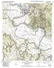
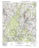
Geologic map of the Bastrop quadrangle, Texas | 2000 | Collins, E.W. | Open-File Map | Bureau of Economic Geology | |
|
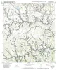
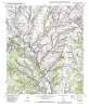
Geologic map of the Bastrop SW quadrangle, Texas | 2000 | Collins, E.W. | Open-File Map | Bureau of Economic Geology | |
|
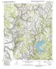
Geologic map of the Coupland quadrangle, Texas | 2000 | Collins, E.W. | Open-File Map | Bureau of Economic Geology | |
|
Geologic map of the Elgin East Quadrangle, Texas | 2000 | Collins, E.W. | Open-File Map | Bureau of Economic Geology | |
|
Geologic map of the Elgin West Quadrangle, Texas | 2000 | Collins, E.W. | Open-File Map | Bureau of Economic Geology | |
|
Geologic map of the Lake Bastrop Quadrangle, Texas | 2000 | Collins, E.W. | Open-File Map | Bureau of Economic Geology | |
|
Geologic map of the Structure Quadrangle, Texas | 2000 | Collins, E.W. | Open-File Map | Bureau of Economic Geology | |
|
Geologic map of the Utley Quadrangle, Texas | 2000 | Collins, E.W. | Open-File Map | Bureau of Economic Geology |