Publications by Wermund, E.G.
| Title | Publication Year Sort ascending | Abstract | Author | Series | Publisher | |
|---|---|---|---|---|---|---|
|
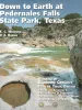
Down to Earth at Pedernales Falls State Park, Texas | 2003 | This nontechnical guidebook describes seven trails that visitors can walk within Pedernales (Spanish for the "flint" found in the park area) State Park, near Johnson City, in the Hill Country of Texas. |
Wermund, E.G., Barnes, V.E. | Down To Earth | Bureau of Economic Geology |
|
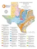
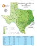
Land-Resource Map of Texas | 1999 | Wermund, E.G. | Thematic Maps | Bureau of Economic Geology | |
|
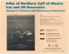
Atlas of northern Gulf of Mexico gas and oil reservoirs: Volume 2. Pliocene and Pleistocene reservoirs | 1997 | Hentz, T.F., Seni, S.J., Wermund, E.G. | Atlases of Major Oil and Gas Reservoirs | Bureau of Economic Geology | |
|
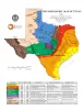
Physiographic Map of Texas | 1996 | Wermund, E.G. | Thematic Maps | Bureau of Economic Geology | |
|
River Basin Map of Texas | 1996 | Wermund, E.G. | Thematic Maps | Bureau of Economic Geology | |
|
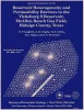
Reservoir heterogeneity and permeability barriers in the Vicksburg S Reservoir, McAllen Ranch gas field, Hidalgo County, Texas | 1994 | This report documents research done on the mature and prolific McAllen Ranch gas field in South Texas, as part of the Secondary Gas Recovery (SGR) project funded by the Gas Research Institute, U.S. |
Langford, R.P., Grigsby, J.D., Collins, R.E., Sippel, M.A., Wermund, E.G. | Report of Investigations | Bureau of Economic Geology |
|
The Guadalupe - Lavaca - San Antonio - Nueces River basins regional study: San Antonio East - Llano East sheets | 1985 | Wermund, E.G., Gustavson, T.C., Garner, L.E., Morton, R.A., Woodruff, C.M., Jr., Macpherson, G.L., McKinney, L., Nilsson, J. | River Basins Regional Studies | Bureau of Economic Geology | |
|
The Guadalupe - Lavaca - San Antonio - Nueces River basins regional study: Seguin West - Austin West sheets | 1985 | Wermund, E.G., Gustavson, T.C., Morton, R.A., Woodruff, C.M., Jr., Macpherson, G.L., McKinney, L., Nilsson, J., Waddell, C.T. | River Basins Regional Studies | Bureau of Economic Geology | |
|
Regional distribution of fractures in the southern Edwards Plateau and their relationship to tectonics and caves | 1977 | In order to better understand the control exerted by fractures on the recharge and production zones of limestone aquifers, the authors delineated surficial fracture zones in the southern Edwards Plateau, Texas. Lineations were marked on nearly 200 mosaics scale of 1:24,000. |
Wermund, E.G., Cepeda, J.C., Luttrell, P.E. | Geological Circular | Bureau of Economic Geology |

|
Upper Pennsylvanian limestone banks, north central Texas | 1975 | Nelson and others (1962) define a bank as " ... a skeletal deposit formed by organisms which do not have the ecologic potential to erect a rigid wave-resistant structure." They explain that a bank may have any geometry. |
Wermund, E.G. | Geological Circular | Bureau of Economic Geology |