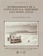
The northern Salt Basin in West Texas and New Mexico is a closed hydrologic system in which discharge of ground-water flow occurs in a series of playas, or salt flats. Ground water originating in peripheral consolidated rocks and alluvial fans flows toward the center of the basin and discharges by evaporation from the salt flats. Progressive increases in salinity are characteristic of the waters moving down gradient and are primarily attributed to evaporative concentration.
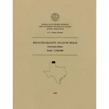
This folded transparent map is at the same scale as its corresponding Geologic Atlas of Texas (GAT) sheet and can be superimposed on it to compare gravity information with surface geology.
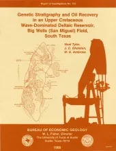
The Big Wells (San Miguel) reservoir in Dimmit and Zavala Counties, South Texas, produces from a broadly lenticular, wave-dominated deltaic sandstone encased in prodelta and shelf mudstones. An updip porosity pinch-out coincides with a gentle undulation on a uniformly gulfward-dipping monocline and forms a structurally modified stratigraphic trap. The reservoir is relatively tight and has average porosity of 21 percent and average permeability of 6 md; wells require fracturing to stimulate production.
This folded transparent map is at the same scale as its corresponding Geologic Atlas of Texas (GAT) sheet and can be superimposed on it to compare gravity information with surface geology.