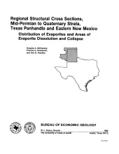
The Palo Duro Basin of the Texas Panhandle and eastern New Mexico contains bedded Permian salts of sufficient thickness and depth for the basin to be considered as a potential site for long-term storage and isolation of high-level nuclear waste. Salt (primarily halite) is a desirable host rock because of its low permeability, high thermal conductivity, low moisture content, and high gamma-ray shielding properties (Johnson, 1976b). A major concern that was addressed during the waste isolation study of the Texas Panhandle region is the long-term integrity of the bedded-salt host rock.
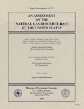
Natural gas in the United States consists of proved reserves in known reservoirs, of inferred reserves and undeveloped resources within these reservoirs, and of undiscovered resources. Other than proved reserves, all volumes of future natural gas supply are estimates based on information derived from past and current experience in gas production and reservoir development. Even proved reserves are subject to periodic revision.
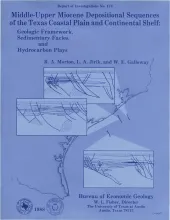
Middle-upper Miocene depositional sequences of offshore Texas represent the last regionally significant influx of terrigenous elastic sediments into the western Gulf Coast Basin.
Permeability in a vuggy carbonate sequence can be related to particle size, separate-vug porosity, and interparticle porosity. Total porosity can be determined from neutron, acoustic, and density logs, but the distinction made between interparticle and separate-vug porosity using log responses has never been quantifiable. As a result, such distinction has never been integrated into permeability estimates drawn from log analysis.