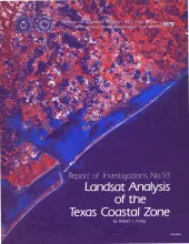
Mapping based on Landsat imagery was initiated along the Texas coast for four test sites selected for contrasting vegetation, environmental geology, and levels of economic development. Standard Landsat transparencies of part of a 1:1,000,000 band 7 image were optically enlarged to fit an existing 1:125,000 map base. Land-water, cropland, and other distinctive boundaries were extracted from the enlargement and compiled on an overlay on which additional unit boundaries from other bands and from the false-color composite of bands 4, 5, and 7 were added.
This report provides a data base for decisions about lignite mining and reclamation in the Wilcox Group of East Texas. Kaiser (1974, 1978) estimates that about 12.2 billion short tons of potentially strip-minable lignite resources occur in East and South Texas. About 8 billion tons of the lignite are within the Wilcox Group in the area of this study (Kaiser, 1978). Lignite production has grown from an estimated 2 million short tons in 1970 to 17 million tons in 1977 (Hawkins and Garner, 1978).