Mexico Publications
| Title | Publication Year Sort ascending | Abstract | Author | Series | Publisher | |
|---|---|---|---|---|---|---|
|
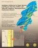
Sandstone Architecture of...Shoreface Deltaic and Valley-fill Complexes, Macuspana Basin, Southeastern Mexico | 2004 | Upper Miocene and Pliocene shoreface and wave-dominated deltaic depocenters in the Macuspana Basin are related primarily to deep-sealed growth faults and large-scale rollover structures associated with shale evacuation. |
Ambrose, W.A., Jones, R.H., Fouad, K. | Report of Investigations | Bureau of Economic Geology |
|
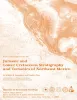
Jurassic and Lower Cretaceous Stratigraphy and Tectonics of Northeast Mexico | 2003 | From 1952 to 1956, Pemex conducted a considerable amount of stratigraphic field work in the eastern Sierra Madre and in Laramide folds to the north across the Sabinas Basin. |
Humphrey, W.E., Diaz, Teodoro, Wilson, J.L., Jordan, Clif | Report of Investigations | Bureau of Economic Geology |
|
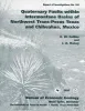
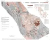
Quaternary faults within intermontane basins of northwest Trans-Pecos Texas and Chihuahua, Mexico | 1997 | This report details the occurrence, geometries, scarp morphology, and paleorupture histories of Quaternary faults of northwest Trans-Pecos Texas and northern Chihuahua, Mexico. |
Collins, E.W., Raney, J.A. | Report of Investigations | Bureau of Economic Geology |
|
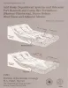
Arid basin depositional systems and paleosols: Fort Hancock and Camp Rice Formations (Pliocene-Pleistocene), Hueco Bolson, West Texas and adjacent Mexico | 1991 | The Hueco Bolson is a segment of the Rio Grande Rift that formed as a result of late Tertiary Basin and Range deformation. The upper Tertiary Fort Hancock Formation and the upper Tertiary-Quaternary Camp Rice Formation compose the basin fill except in the deepest (western) parts of the bolson. |
Gustavson, T.C. | Report of Investigations | Bureau of Economic Geology |
|
Tertiary and Quaternary structure and paleotectonics of the Hueco Basin, Trans-Pecos Texas and Chihuahua, Mexico | 1991 | The Hueco Basin of Trans-Pecos Texas, which formed in response to Cenozoic extensional tectonism, lies within the southern Rio Grande rift near the poorly defined boundary between the rift and the southern Basin and Range province. |
Collins, E.W., Raney, J.A. | Geological Circular | Bureau of Economic Geology |
|
Neotectonic history and structural style of the Campo Grande fault, Hueco basin, Trans-Pecos Texas | 1990 | The Hueco Basin of Trans-Pecos Texas and Chihuahua, Mexico, formed in response to Basin and Range extensional tectonism that began about 24 Ma ago and continues to the present. |
Collins, E.W., Raney, J.A. | Report of Investigations | Bureau of Economic Geology |
|
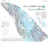
Tectonic map of the Basin and Range Province of Texas and adjacent Mexico | 1985 | Henry, C.D., Price, J.G., Gluck, J.K., Bockoven, N.T. | Miscellaneous Map | Bureau of Economic Geology | |
|
Tectonic map of the Rio Grande area, Trans-Pecos Texas and adjacent Mexico | 1977 | Henry, C.D., Bockoven, N.T. | Miscellaneous Map | Bureau of Economic Geology | |
|
Lower Cretaceous Stratigraphy, Northern Coahuila, Mexico | 1970 | This report presents stratigraphic data and interpretations pertaining to the origin of a continental shelf-ocean basin sedimentary complex developed during Lower Cretaceous time in northern Coahuila, Mexico. |
Smith, C.I. | Report of Investigations | Bureau of Economic Geology |