Shoreline Change Publications
| Title | Publication Year Sort ascending | Abstract | Author | Series | Publisher | |
|---|---|---|---|---|---|---|
|
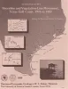
Shoreline and vegetation-line movement, Texas Gulf coast, 1974 to 1982 | 1989 | The purposes of this study were (1) to quantify recent (1974 to 1982) movement of Texas shorelines and vegetation lines by analysis of aerial photographs; (2) to place this movement in historical (pre-1974) context; and (3) to examine the influence of environmental variables such as storms, sea l |
Paine, J.G., Morton, R.A. | Geological Circular | Bureau of Economic Geology |
|
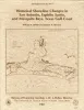
Historical shoreline changes in San Antonio, Espiritu Santo, and Mesquite Bays, Texas Gulf coast | 1987 | Changes in the position and stability of shorelines in the San Antonio Bay system (San Antonio, Espiritu Santo, and Mesquite Bays), Texas Gulf Coast, were documented using historical monitoring techniques. |
White, W.A., Morton, R.A. | Geological Circular | Bureau of Economic Geology |
|
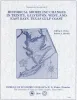
Historical shoreline changes in Trinity, Galveston, West, and East Bays, Texas Gulf coast | 1986 | Changes in shoreline position occurring for more than a century provide estimates of the relative stability of shorelines and, along the Texas coast, allow comparisons of shoreline changes before and after human modifications became significant. |
Paine, J.G., Morton, R.A. | Geological Circular | Bureau of Economic Geology |
|
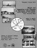
Beach and vegetation-line changes at Galveston Island, Texas: erosion, deposition, and recovery from Hurricane Alicia | 1985 | On August 18, 1983, Hurricane Alicia crossed the upper Texas Gulf Coast and caused extensive property damage, especially along West Beach of Galveston Island. |
Morton, R.A., Paine, J.G. | Geological Circular | Bureau of Economic Geology |
|
Historical shoreline changes in Corpus Christi, Oso, and Nueces Bays, Texas Gulf coast | 1984 | Changes in the position and stability of shorelines around Corpus Christi, Oso, and Nueces Bays, Texas Gulf Coast, were documented using historical-monitoring techniques. |
Morton, R.A., Paine, J.G., Robinson, D.E. | Geological Circular | Bureau of Economic Geology |
|
Shoreline changes on Mustang Island and North Padre Island (Aransas Pass to Yarborough Pass) -- an analysis of historical changes of the Texas Gulf shoreline | 1977 | Historical monitoring along Mustang and north Padre Islands records the nature and magnitude of changes in position of the shoreline and vegetation line and provides insight into the factors affecting those changes. |
Morton, R.A., Pieper, M.J. | Geological Circular | Bureau of Economic Geology |
|
Shoreline changes on central Padre Island (Yarborough Pass to Mansfield Channel) -- an analysis of historical changes of the Texas Gulf shoreline | 1977 | Historical monitoring along central Padre Island records the nature and magnitude of changes in position of the shoreline and vegetation line and provides insight into the factors affecting those changes. |
Morton, R.A., Pieper, M.J. | Geological Circular | Bureau of Economic Geology |
|
Shoreline changes on Matagorda Island and San Jose Island (Pass Cavallo to Aransas Pass) -- an analysis of historical changes of the Texas Gulf shoreline | 1976 | Historical monitoring along Matagorda Island and San Jose Island records the nature and magnitude of changes in position of the shoreline and vegetation line and provides insight into the factors affecting those changes. |
Morton, R.A., Pieper, M.J. | Geological Circular | Bureau of Economic Geology |
|
Shoreline changes on Matagorda Peninsula (Brown Cedar Cut to Pass Cavallo) -- an analysis of historical changes of the Texas Gulf shoreline | 1976 | Historical monitoring along Matagorda Peninsula from Brown Cedar Cut to Pass Cavallo records the nature and magnitude of changes in position of the shoreline and vegetation line and provides insight into the factors affecting those changes. |
Morton, R.A., Pieper, M.J., McGowen, J.H. | Geological Circular | Bureau of Economic Geology |
|
Shoreline changes on Brazos Island and south Padre Island (Mansfield Channel to north of the Rio Grande) -- an analysis of historical changes of the Texas Gulf shoreline | 1975 | Historical monitoring along Brazos and south Padre Islands records the nature and magnitude of changes in position of the shoreline and vegetation line and provides insight into the factors affecting those changes. |
Morton, R.A., Pieper, M.J. | Geological Circular | Bureau of Economic Geology |