|
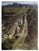
Austin and Beyond--Geology and Environment: A Field Excursion in Memory of L. Edwin Garner |
Woodruff, C.M., Jr., Collins, E.W. |
2001 |
Austin Geological Society |
|
GCAGS Transactions Volume 51 (2001) Shreveport |
|
2001 |
Gulf Coast Association of Geological Societies |
|
Annual Report of the Bureau of Economic Geology 2001 |
University of Texas at Austin, Bureau of Economic Geology |
2001 |
Annual Reports |
|
Structure and Evolution of Upheaval Dome: Pinched-Off Salt Diapir or Meteoritic Impact Structure? |
Jackson, M.P.A., Schultz-Ela, D.D., Hudec, M.R., Watson, I.A., Porter, M.L. |
2001 |
Report of Investigations |
|
Competing effects of depositional architecture and diagenesis on carbonate reservoir development: Grayburg Formation, South Cowden field, West Texas |
Ruppel, S.C., Bebout, D.G. |
2001 |
Report of Investigations |
|
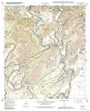
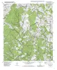
Geologic map of the Winchester quadrangle, Texas |
Collins, E.W. |
2001 |
Open-File Map |
|
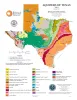
Aquifers of Texas |
Hovorka, S.D. |
2001 |
Thematic Maps |
|
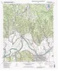
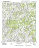
Geologic map of the Paige quadrangle, Texas |
Collins, E.W. |
2001 |
Open-File Map |
|
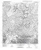
Geologic map of the Concan quadrangle, Texas |
Collins, E.W. |
2001 |
Open-File Map |
|
Genesis and Controls of Reservoir-Scale Carbonate Deformation, Monterrey Salient, Mexico |
Marrett, R. |
2001 |
Guidebook |
|
Geologic map of the Smithville Quadrangle, Texas |
Collins, E.W. |
2001 |
Open-File Map |
|
Studies on the Cave and Endogean Fauna of North America III |
|
2001 |
Texas Memorial Museum |
|
Geologic map of the Smithville NW Quadrangle, Texas |
Collins, E.W. |
2001 |
Open-File Map |
|
Geologic map of the Beaukiss quadrangle, Texas |
Collins, E.W. |
2001 |
Open-File Map |
|
Geologic map of the Circle Bluff quadrangle, Texas |
Collins, E.W. |
2001 |
Open-File Map |
|
Using 3-D Seismic Coherency and Stratal Surfaces to Optimize Redevelopment of Waterflooded Reservoirs, Cut Bank Field, Montana |
DeAngelo, M.V., Hardage, B.A. |
2001 |
Geological Circular |
|
Geologic map of the Fedor quadrangle, Texas |
Collins, E.W. |
2001 |
Open-File Map |
|
Geologic map of the Knippa quadrangle, Texas |
Collins, E.W. |
2001 |
Open-File Map |
|
Estimating Transmissivity Using Specific-Capacity Data |
Mace, R.E. |
2001 |
Geological Circular |
|
Geologic Map of West Hueco Bolson, El Paso Region, Texas |
Collins, E.W., Raney, J.A. |
2000 |
Miscellaneous Map |