|
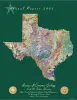
Annual Report of the Bureau of Economic Geology 2003 |
University of Texas at Austin, Bureau of Economic Geology |
2003 |
Annual Reports |
|
Quick-Look Chart for Restoration of Salt Structures in Cross Section |
Hudec, M.R. |
2003 |
Educational Material |
|
Jurassic and Lower Cretaceous Stratigraphy and Tectonics of Northeast Mexico |
Humphrey, W.E., Diaz, Teodoro, Wilson, J.L., Jordan, Clif |
2003 |
Report of Investigations |
|
Down to Earth at Pedernales Falls State Park, Texas |
Wermund, E.G., Barnes, V.E. |
2003 |
Down To Earth |
|
Salt-Related Fault Families and Fault Welds in the Northern Gulf of Mexico |
Jackson, M.P.A., Rowan, M.G. |
2003 |
Report of Investigations |
|
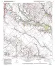
Geologic map of the Seymour aquifer deposits, Vernon, Texas 30x60 minute quadrangle, Texas |
Collins, E.W. |
2003 |
Open-File Map |
|
Hydraulic properties of the Carrizo-Wilcox aquifer in Texas: information for groundwater modeling, planning, and management |
Mace, R.E., Smyth, R.C. |
2003 |
Report of Investigations |
|
Legends in Wildcatting 2003 |
|
2003 |
Houston Geological Society |
|
Shelf Margin Deltas and Linked Down Slope Petroleum Systems |
|
2003 |
Gulf Coast Section SEPM |
|
Structure and Stratigraphy of South Texas and Northeast Mexico |
|
2003 |
Gulf Coast Section SEPM |
|
The Story of the Texas National Research Laboratory Commission and the Superconducting Super Collider: How Texas Won..and Lost |
Flawn, P.T. |
2003 |
Udden Series |
|
Play-based assessment of hydrocarbon resources in University Lands reservoirs, Permian Basin, West Texas |
Kim, E.M., Ruppel, S.C. |
2003 |
Geological Circular |
|
Geologic map of the Blanco quadrangle, Texas |
Collins, E.W. |
2002 |
Open-File Map |
|
GCAGS Transactions Volume 52 (2002) Austin |
|
2002 |
Gulf Coast Association of Geological Societies |
|
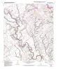
Geologic map of the Henly quadrangle, Texas |
Collins, E.W. |
2002 |
Open-File Map |
|
Annual Report of the Bureau of Economic Geology 2002 |
University of Texas at Austin, Bureau of Economic Geology |
2002 |
Annual Reports |
|
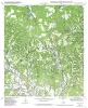
Geologic map of the Uhland quadrangle, Texas |
Collins, E.W. |
2002 |
Open-File Map |
|
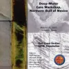
Deep-Water Core Workshop, Northern Gulf of Mexico, 2002. CD-ROM |
|
2002 |
Gulf Coast Section SEPM |
|
Geologic map of the Martindale quadrangle, Texas |
Collins, E.W. |
2002 |
Open-File Map |
|
Geologic map of the Cypress Creek quadrangle, Texas |
Collins, E.W. |
2002 |
Open-File Map |