|
Annual Report of the Bureau of Economic Geology 2011 |
University of Texas at Austin, Bureau of Economic Geology |
2011 |
Annual Reports |
|
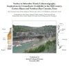
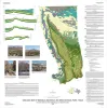
Surface to Subsurface Trinity Lithostratigraphy: Implications for Groundwater Availability in the Hill Country, Eastern Blanco and Northern Hays Counties, Texas |
Hunt, B.B., Wierman, D.A., Brown, A.S., Woodruff, C.M., Jr., Fielder, R.G. |
2011 |
Austin Geological Society |
|
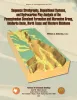
Sequence Stratigraphy, Depositional Systems, and Hydrocarbon Play Analysis of the Pennsylvanian Cleveland Formation and Marmaton Group, Anadarko Basin, North Texas and Western Oklahoma |
Ambrose, W.A. |
2011 |
Report of Investigations |
|
The Salt Mine: A Digital Atlas of Salt Tectonics |
Hudec, M.R., Jackson, M.P.A. |
2011 |
Udden Series |
|
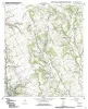
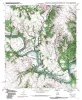
Geologic map of the Brazos Point quadrangle, Texas |
Collins, E.W. |
2010 |
Open-File Map |
|
Geologic map of the Lakeside Village quadrangle, Texas |
Collins, E.W. |
2010 |
Open-File Map |
|
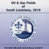
Oil and Gas Fields of South Louisiana 2010 |
|
2010 |
New Orleans Geological Society |
|
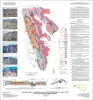
Eagle Ford (Boquillas) Formation |
|
2010 |
South Texas Geological Society |
|
Geologic map of Mariscal Mountain, Big Bend National Park, Texas |
Dickerson, P.W., Muehlberger, W.R., Collins, E.W. |
2010 |
Miscellaneous Map |
|
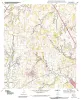
Geologic map of the Blanton quadrangle, Texas |
Collins, E.W. |
2010 |
Open-File Map |
|
Oil and Gas Fields of South Louisiana 2010. CD-ROM |
|
2010 |
New Orleans Geological Society |
|
Geologic map of the Southern Franklin Mountains, El Paso, Texas, with focus on collapse breccia |
Lucia, F.J. |
2010 |
Miscellaneous Map |
|
Geologic map of the Hillsboro West quadrangle, Texas |
Collins, E.W. |
2010 |
Open-File Map |
|
Geologic map of the Keene quadrangle, Texas |
Collins, E.W. |
2010 |
Open-File Map |
|
GCAGS Transactions Volume 60 (2000), San Antonio |
|
2010 |
Gulf Coast Association of Geological Societies |

|
Annual Report of the Bureau of Economic Geology 2010 |
University of Texas at Austin, Bureau of Economic Geology |
2010 |
Annual Reports |
|
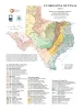
Ecoregions of Texas |
University of Texas at Austin, Bureau of Economic Geology |
2010 |
Thematic Maps |
|
Sequence Stratigraphy, Depositional Facies, and Reservoir Attributes of the Upper Cretaceous Woodbine Group, East Texas Field |
Hentz, T.F. |
2010 |
Report of Investigations |
|
Sequence Stratigraphy, Depositional Systems, and Production Trends in the Atoka Series and Mid-Pennsylvanian Cleveland and Marmaton Formations, Western Anadarko Basin |
Carr, David, Hentz, T.F., Ambrose, W.A., Potter, E.C., Clift, S.J. |
2009 |
Seminars and Workshops |
|
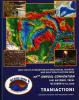
GCAGS Transactions Volume 59 (2009) Shreveport |
|
2009 |
Gulf Coast Association of Geological Societies |