|
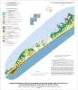
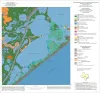
Geo-Environmental map of Southwest Galveston Island, San Luis Pass and Sea Isle quadrangles, Texas Gulf of Mexico |
Tremblay, T.A., Gibeaut, J.C., Waldinger, R.L., White, W.A., Collins, E.W. |
2006 |
Open-File Map |
|
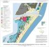
Geo-Environmental map of Northern Mustang Island, Port Aransas quadrangle, Texas Gulf of Mexico Coast |
Tremblay, T.A., Gibeaut, J.C., Waldinger, R.L., White, W.A., Collins, E.W. |
2006 |
Open-File Map |
|
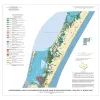
Geo-Environmental map of Southern Mustang Island, Crane Islands NW quadrangle, Texas Gulf of Mexico Coast |
Tremblay, T.A., Gibeaut, J.C., Waldinger, R.L., White, W.A., Collins, E.W. |
2006 |
Open-File Map |
|
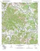
Geologic map of the Rock Cliff Reservoir quadrangle, Texas |
Collins, E.W. |
2004 |
Open-File Map |
|
Geoenvironmental map of the Christmas Point quadrangle, Texas |
Tremblay, T.A., White, W.A., Waldinger, R.L., Collins, E.W. |
2004 |
Open-File Map |
|
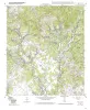
Geologic map of the A Bar A quadrangle, Texas |
Collins, E.W. |
2004 |
Open-File Map |
|
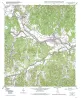
Geologic map of the Bandera Pass quadrangle, Texas |
Collins, E.W. |
2004 |
Open-File Map |
|
Geologic map of the Center Point quadrangle, Texas |
Collins, E.W. |
2004 |
Open-File Map |
|
Geologic map of the Echo Hill Ranch quadrangle, Texas |
Collins, E.W. |
2004 |
Open-File Map |
|
Geologic map of the Fall Creek quadrangle, Texas |
Collins, E.W. |
2004 |
Open-File Map |
|
Geologic map of the Hunt quadrangle, Texas |
Collins, E.W. |
2004 |
Open-File Map |
|
Geologic map of the Kerrville quadrangle, Texas |
Collins, E.W. |
2004 |
Open-File Map |
|
Geologic map of the Legion quadrangle, Texas |
Collins, E.W. |
2004 |
Open-File Map |
|
Geologic map of the Love Creek quadrangle, Texas |
Collins, E.W. |
2004 |
Open-File Map |

|
Geologic map of the Seymour aquifer deposits, Vernon, Texas 30x60 minute quadrangle, Texas |
Collins, E.W. |
2003 |
Open-File Map |
|
Geologic map of the Hutto Quadrangle, Texas |
Collins, E.W. |
2002 |
Open-File Map |
|
Geologic map of the Rough Hollow quadrangle, Texas |
Collins, E.W. |
2002 |
Open-File Map |
|
Geologic map of the Shingle Hills quadrangle, Texas |
Collins, E.W. |
2002 |
Open-File Map |
|
Geologic map of the Whitworth Ranch quadrangle, Texas |
Collins, E.W. |
2002 |
Open-File Map |
|
Geologic map of the Payton quadrangle, Texas |
Collins, E.W. |
2002 |
Open-File Map |