Get the Publication
Abstract/Description:
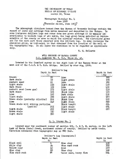
These circulars issued from the Bureau of Economic Geology contain the record of cores and cuttings from well received and described in the Bureau. In some instances, driller's logs and other data are given, although it is usually impracticable to include logs of all wells, the logs given being selected as representative of the county or area to which the circular relates. The elevations given are for the most part those reported with the driller's log. In some instances the elevation given, as indicated, is that obtained from the location of the well on the topographic map. In all cases the elevation is to be regarded as approximate only.--- E. H. Sellards
This circular contains the following short sections:
R. L. Anderson no. 2, G. L. Bloom et al., 9 mi east of La Pryor. Drilled by star rig, 1920 -- and--
H. L. Graves No. 1. Drilled by cable tools.
Samples described by E. H. Stiles and D. D. Christner, submitted by G. Jeffreys, 1921.
Ike T. Pryor No. 1, Century Oil and Gas Company. Drilled by rotary. Samples described by E. H. Stiles, H. T. Kniker, and W. M. Winton, submitted by Lee S. Miller, Uvalde, 1921.
Ike T. Pryor No. 1, La Pryor Oil and Gas Company, 10 mi NE of La Pryor. Samples described by J. A. Udden and P. T. Seashore, submitted by G. Jeffreys, 1921,
Ike T. Pryor No. 1, National Oil and Refining Company. 5 miles NE of La Pryor. Samples described by J. A. Udden and H. T. Kniker, submitted by G. Jeffreys, 1919.
Ike T. Pryor No. 2, National Oil and Refining Company. 7200 ft NE of Ike T. Pryor No. 1.
Ike T. Pryor No. 1, Old Dominion Oil Company, 2 mi north and 1 mi est of La Pryor. Cuttings, described by E. H. Sellards and O. M. Richey, 1925, submitted by F. F. Kuhlman, San Antonio.