Publications in Winkler
| Title | Publication Year Sort ascending | Abstract | Author | Series | Publisher | |
|---|---|---|---|---|---|---|
|
Geological controls on reservoir development in a Leonardian (Lower Permian) carbonate platform reservoir, Monahans field, West Texas | 2002 | This report combines borehole core and geophysical log study with porosity and permeability data to define patterns of facies and permeability distribution in a typical upper Clear Fork reservoir in the Permian Basin. |
Ruppel, S.C. | Report of Investigations | Bureau of Economic Geology |
|
Depositional and diagenetic facies patterns and reservoir development in Silurian and Devonian rocks of the Permian basin | 1994 | Silurian and Devonian carbonate and chert rocks in the Permian Basin constitute a prolific hydrocarbon-bearing succession in West Texas and New Mexico. |
Ruppel, S.C., Holtz, M.H. | Report of Investigations | Bureau of Economic Geology |
|
Stratigraphic analysis of the Upper Devonian Woodford Formation, Permian Basin, West Texas and southeastern New Mexico | 1991 | The Upper Devonian Woodford Formation is an organic-rich petroleum source rock that extends throughout West Texas and southeastern New Mexico and currently is generating oil or gas in the subsurface. |
Comer, J.B. | Report of Investigations | Bureau of Economic Geology |
|
Bouguer gravity Atlas of Texas, Hobbs sheet | 1986 | This folded transparent map is at the same scale as its corresponding Geologic Atlas of Texas (GAT) sheet and can be superimposed on it to compare gravity information with surface geology. |
Keller, G.R., Aiken, C.L.V. | Bouguer Gravity Atlas of Texas | Bureau of Economic Geology |
|
Regional cross sections -- central basin platform, West Texas | 1985 | In 1982, the Bureau of Economic Geology initiated a project to characterize the major oil fields of Texas. |
Bebout, D.G., Meador, K.J. | Cross Sections | |
|
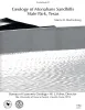
Geology of Monahans Sandhills State Park, Texas | 1984 | Sand dunes at Monahans Sandhills State Park display a variety of dune forms that develop under a unique trimodal wind regime. Large expanses of unvegetated sand form akle dunes having reversing slip faces. |
Machenberg, M.D. | Guidebook | Bureau of Economic Geology |
|
Formation of the Wink Sink, a salt dissolution and collapse feature, Winkler County, Texas | 1982 | The Wink Sink in Winkler County, Texas, formed on June 3, 1980. Within 24 hours it had expanded to a maximum width of 360 ft (110 m). On June 5, 1980, maximum depth of the sinkhole was 110 ft (34 m), and volume about 5.6 million ft3 (158,600 m3). |
Baumgardner, R.W., Jr., Hoadley, A.D., Goldstein, A.G., Hummel, Gary, Young, D'nese, Sandstrom, M.A., Forman, J.L. | Report of Investigations | Bureau of Economic Geology |
|
Genesis and emplacement of oil in the San Andreas Formation, northern shelf of the Midland basin, Texas | 1982 | San Andres oil constitutes more than 80 percent of the total production from the Northern Shelf of the Midland Basin, Texas. |
Ramondetta, P.J. | Report of Investigations | Bureau of Economic Geology |
|
Facies and stratigraphy of the San Andreas Formation, northern and northwestern shelves of the Midland basin, Texas and New Mexico | 1982 | The San Andres Formation on the Northern and Northwestern Shelves of the Midland Basin is a progradational stratigraphic unit consisting predominantly of carbonate facies. Lithofacies include dolomite, laminated anhydrite and dolomite, massive bedded anhydrite, limestone, salt, and red beds. |
Ramondetta, P.J., Guetzow, D.D., Dauzat, Rick, Merritt, R.M., Garza, John, Holman, Lee, Roques, Dominick | Report of Investigations | Bureau of Economic Geology |
|
Depositional framework of the Lower Dockum Group (Triassic), Texas panhandle | 1979 | The Upper Triassic Dockum Group of Texas and New Mexico is composed of 200 to 2,000 feet of complexly interrelated terrigenous clastic facies ranging from mudstone to conglomerate. |
McGowen, J.H., Granata, G.E., Seni, S.J. | Report of Investigations | Bureau of Economic Geology |