Publications in Wilson
| Title | Publication Year Sort ascending | Abstract | Author | Series | Publisher | |
|---|---|---|---|---|---|---|
|
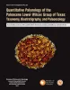
Quantitative palynology of the Paleocene Lower Wilcox Group of Texas: taxonomy, biostratigraphy, and paleoecology | 2025 | Palynological analysis of four onshore wells (Edmond Olinick No 1, Jerome Olinick No 16, Lawrence Keseling No 1, Moczygemba VT No 11) in the Paleocene Lower Wilcox Group of Texas in the United States has yielded abundant and diverse palynomorph taxa from Paleocene shallow marine deltaic paleoenvi |
Smith, Vann, Moscardelli, Lorena, Bord, D., Lorente, M.A., Olariu, M.I. | Report of Investigations | Bureau of Economic Geology |
|
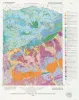
Geologic map of the Leming quadrangle, Texas | 2019 | Elliott, Brent A. | Open-File Map | Bureau of Economic Geology | |
|
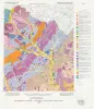
Geologic map of the Losoya quadrangle, Texas | 2014 | Elliott, Brent A. | Open-File Map | Bureau of Economic Geology | |
|
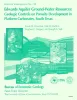
Edwards aquifer ground-water resources: geologic controls on porosity development in platform carbonates, south Texas | 1996 | Focusing on the highly developed Edwards aquifer, which supplies water for a large area of south-central Texas, this report presents a three-dimensional model of the porosity distribution in the aquifer, which quantifies the spatial distribution of water resources and provides information that ca |
Hovorka, S.D., Dutton, A.R., Ruppel, S.C., Yeh, J.S. | Report of Investigations | Bureau of Economic Geology |
|
Depositional and ground-water flow systems of the Carrizo - Upper Wilcox, south Texas | 1988 | In the Rio Grande Embayment of South Texas, the Carrizo Formation (lower Eocene) consists of two sand-rich fluvial depositional systems that grade basinward into several deltaic complexes within the upper part of the Wilcox Group. |
Hamlin, H.S. | Report of Investigations | Bureau of Economic Geology |
|
The Guadalupe - Lavaca - San Antonio - Nueces River basins regional study: San Antonio East - Llano East sheets | 1985 | Wermund, E.G., Gustavson, T.C., Garner, L.E., Morton, R.A., Woodruff, C.M., Jr., Macpherson, G.L., McKinney, L., Nilsson, J. | River Basins Regional Studies | Bureau of Economic Geology | |
|
The Guadalupe - Lavaca - San Antonio - Nueces River basins regional study: Seguin West - Austin West sheets | 1985 | Wermund, E.G., Gustavson, T.C., Morton, R.A., Woodruff, C.M., Jr., Macpherson, G.L., McKinney, L., Nilsson, J., Waddell, C.T. | River Basins Regional Studies | Bureau of Economic Geology | |
|
Depositional and diagenetic history of the Sligo and Hosston Formations(Lower Cretaceous) in south Texas | 1981 | The Sligo and Hosston Formations of Aptian age occur over thousands of square miles in the subsurface of South Texas. |
Bebout, D.G., Budd, D.A., Schatzinger, R.A. | Report of Investigations | Bureau of Economic Geology |
|
Smackover and lower Buckner Formations, south Texas: depositional systems on a Jurassic carbonate ramp | 1981 | The Smackover and lower part of the Buckner Formations (Oxfordian) comprise a thick regressive sedimentary sequence deposited on a Jurassic carbonate ramp. Four major depositional systems are recognized: (1) basinal, (2) low-energy open shelf, (3) high-energy shoal, and (4) sabkha. |
Budd, D.A., Loucks, R.G. | Report of Investigations | Bureau of Economic Geology |

|
Structural cross sections, Tertiary formations, Texas Gulf Coast | 1981 | The publication comprises 24 structural dip cross sections, spaced 15 to 20 mi apart along the Texas coast, and 4 structural strike cross sections. Dip sections extend from near the Wilcox outcrop to the coastline. |
Dodge, M.M., Posey, J.S. | Cross Sections | Bureau of Economic Geology |