Publications in Rockwall
| Title | Publication Year Sort ascending | Abstract | Author | Series | Publisher | |
|---|---|---|---|---|---|---|
|
Cotton Valley (Upper Jurassic) and Hosston (Lower Cretaceous) depositional systems and their influence on salt tectonics in the east Texas basin | 1984 | Correct interpretation of the effect of basin infilling on salt mobilization is critical to understanding salt dome growth and stability. The size of salt structures in the East Texas Basin is determined by the original thickness of the underlying Louann Salt (Middle Jurassic). |
McGowen, M.K., Harris, D.W. | Geological Circular | Bureau of Economic Geology |

|
Depositional systems in the Nacatoch Formation (Upper Cretaceous), northeast Texas and southwest Arkansas | 1983 | The Nacatoch Formation of the East Texas Basin is the middle formation of the Navarro Group and consists of marine sandstones and mudstones derived largely from source areas to the northwest, north, and northeast of the East Texas Embayment. |
McGowan, M.K., Lopez, C.M. | Report of Investigations | Bureau of Economic Geology |
|
Fault tectonics of the east Texas basin | 1982 | Principal fault systems in the East Texas Basin were examined in terms of their distribution, geometry, displacement history, and possible origins. |
Jackson, M.P.A., Wilson, B.D. | Geological Circular | Bureau of Economic Geology |
|
Hydrocarbon accumulation patterns in the east Texas salt dome province | 1982 | Mobilization of the Louann Salt created the present structural configuration in the central part of the East Texas Basin and was the major control on hydrocarbon accumulation in the area. Salt-cored anticlines, turtle-structure anticlines, and salt diapirs were produced by flow of salt. |
Wood, D.H., Giles, A.B. | Geological Circular | Bureau of Economic Geology |
|
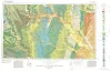
Geologic Atlas of Texas, Dallas sheet (revised 1987) | 1972 | Geologic map that depicts surface geology of Tarrant, Dallas, Kaufman, Ellis, Johnson, Somervell, and Rockwall Counties and parts of Parker, Hood, Erath, Bosque, Hill, Navarro, Henderson, Van Zandt, and Hunt Counties, Texas. |
Barnes, V.E., Shell Oil Co., Humble Oil and Refining Co., Dallas Geological Society, Fort Worth Geological Society, McGowen, J.H., Proctor, C.V., Jr., Haenggi, W.T. | Geologic Atlas of Texas | Bureau of Economic Geology |
|
Underground waters and subsurface temperatures of the Woodbine sand in northeast Texas | 1931 | Plummer, F.B., Sargent, E.C. | UT Bulletin |