Publications in Nueces
| Title | Publication Year Sort ascending | Abstract | Author | Series | Publisher | |
|---|---|---|---|---|---|---|
|
Regional hydrodynamics and hydrochemistry of the uranium-bearing Oakville aquifer (Miocene) of south Texas | 1982 | The Oakville Formation consists of sediments deposited by several major fluvial systems that traversed the Texas Coastal Plain during the Miocene Epoch. |
Smith, G.E., Galloway, W.E., Henry, C.D., Gluck, J.K., McIntyre, J.F., Pisasale, E.T., Spradlin, S.D. | Report of Investigations | Bureau of Economic Geology |
|
Considerations in the extraction of uranium from a fresh-water aquifer -- Miocene Oakville Sandstone, south Texas | 1982 | The Miocene Oakville Sandstone is a major aquifer and uranium host beneath the Texas Coastal Plain. In 1976, approximately 6,000 acre-ft of ground water were withdrawn from the Oakville for municipal use. |
Henry, C.D., Galloway, W.E., Smith, G.E., Childs, C.S., Devine, P.E., Dutton, A.R., Gluck, J.K., McIntyre, J.F. | Report of Investigations | Bureau of Economic Geology |

|
Structural cross sections, Tertiary formations, Texas Gulf Coast | 1981 | The publication comprises 24 structural dip cross sections, spaced 15 to 20 mi apart along the Texas coast, and 4 structural strike cross sections. Dip sections extend from near the Wilcox outcrop to the coastline. |
Dodge, M.M., Posey, J.S. | Cross Sections | Bureau of Economic Geology |
|
Upper Tertiary and Quaternary depositional systems, central coastal plain, Texas -- regional geology of the coastal aquifer and potential liquid-waste repositories | 1981 | Upper Miocene, Pliocene, and Pleistocene deposits in the subsurface of the central Coastal Plain of Texas were subdivided into six operational units comprising the surface-defined Fleming, Goliad, Willis, Lissie, and Beaumont Formations. |
Solis-Iriarte, R.F. | Report of Investigations | Bureau of Economic Geology |
|
Importance of Secondary Leached Porosity in Lower Tertiary Sandstone Reservoirs along the Texas Gulf Coast | 1980 | Secondary leached porosity is common to dominant in near surface to deep subsurface lower Tertiary sandstone reservoirs along the Texas Gulf Coast. This secondary porosity is in the form of leached feldspar grains, volcanic rock fragments, carbonate cements, and carbonate-replaced grains. |
Loucks, R.G., Dodge, M.M., Galloway, W.E. | Geological Circular | Bureau of Economic Geology |
|
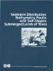
Sediment distribution, bathymetry, faults, and salt diapirs, submerged lands of Texas | 1979 | The State-owned submerged lands of Texas encompass nearly 6,000 square miles (15,540 km²) and extend from Mexico to Louisiana. The area includes the bays, estuaries, and lagoons, as well as the inner continental shelf 10.3 miles (16.6 km) seaward of the Gulf shoreline (fig. 1). |
McGowen, J.H., Morton, R.A. | Selected Reports | Bureau of Economic Geology |
|
Depositional patterns of Miocene facies, middle Texas coastal plain | 1979 | Doyle, J.D. | Report of Investigations | Bureau of Economic Geology | |

|
Sandstone distribution and potential for geopressured geothermal energy production in the Vicksburg Formation along the Texas Gulf coast | 1979 | Potential geopressured geothermal reservoirs in the Vicksburg Formation are limited to Hidalgo County along the Lower Texas Gulf Coast. |
Loucks, R.G. | Geological Circular | Bureau of Economic Geology |
|
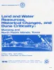
Land and water resources, historical changes, and dune criticality: Mustang and North Padre Islands, Texas | 1978 | Barrier islands along the Texas Coastal Zone are part of a complex and dynamic system represented by many distinct yet interrelated environments affected by a variety of resources, natural processes, climatic conditions, and human activities. |
White, W.A., Morton, R.A., Kerr, R.S., Kuenzi, W.D., Brogden, W.B. | Report of Investigations | Bureau of Economic Geology |
|
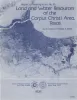
Land and water resources of the Corpus Christi area, Texas | 1978 | Land and water resources have been analyzed in the Corpus Christi area--Aransas, Nueces, Refugio, and San Patricio Counties along the central Texas coast. The city and port of Corpus Christi compose the largest metropolitan center in the area. |
Kier, R.S., White, W.A. | Report of Investigations | Bureau of Economic Geology |