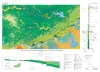
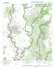
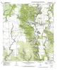
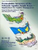
Publications in Medina
Title | Publication Year | Abstract | Author | Series | Publisher | |
---|---|---|---|---|---|---|
![]() |
Geologic Atlas of Texas, San Antonio sheet (revised 1982) | 1974 | Geologic map that depicts the surface geology of Comal, Bandera, Bexar, and Medina Counties and parts of Real, Kerr, Kendall, Hays, Guadalupe, Wilson, Atascosa, Frio, Zavala, and Uvalde Counties, Texas. The 9-page booklet indicates geologic formations, abbreviations, and ages. |
Barnes, V.E., Shell Oil Co., Amerada Petroleum Corp., Brown, T.E., Waechter, N.B., Dillon, R.L. | Geologic Atlas of Texas | Bureau of Economic Geology |
![]() |
Regional distribution of fractures in the southern Edwards Plateau and their relationship to tectonics and caves | 1977 | In order to better understand the control exerted by fractures on the recharge and production zones of limestone aquifers, the authors delineated surficial fracture zones in the southern Edwards Plateau, Texas. Lineations were marked on nearly 200 mosaics scale of 1:24,000. |
Wermund, E.G., Cepeda, J.C., Luttrell, P.E. | Geological Circular | Bureau of Economic Geology |
![]() |
Structure Map of the San Antonio Segment of the Edwards Aquifer and Balcones Fault Zone, South-Central Texas: Structural Framework of a Major Limestone Aquifer: Kinney, Uvalde, Medina, Bexar, Comal, and Hays Counties | 1997 | Collins, E.W., Hovorka, S.D. | Miscellaneous Map | Bureau of Economic Geology | |
![]() |
Geologic Map of the New Braunfels, Texas, 30x60 Minute Quadrangle | 2000 | Collins, E.W. | Miscellaneous Map | Bureau of Economic Geology | |
![]() |
Geologic map of the Tarpley Quadrangle, Texas | 1997 | Collins, E.W. | Open-File Map | Bureau of Economic Geology | |
![]() |
Geologic map of the Texas Mountain quadrangle, Texas | 1997 | Collins, E.W. | Open-File Map | Bureau of Economic Geology | |
![]() |
Geologic map of the Timber Creek Quadrangle, Texas | 1997 | Collins, E.W. | Open-File Map | Bureau of Economic Geology | |
![]() |
Geologic map of the Twin Hollow Quadrangle, Texas | 1997 | Collins, E.W. | Open-File Map | Bureau of Economic Geology | |
![]() |
Geologic map of the San Geronimo Quadrangle, Texas | 1995 | Collins, E.W. | Open-File Map | Bureau of Economic Geology | |
![]() |
Geologic map of the Castroville quadrangle, Texas | 1998 | Collins, E.W. | Open-File Map | Bureau of Economic Geology |