|
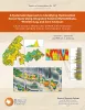
A systematic approach to identifying hydrocarbon sweet spots using integrated seismic multiattribute, wireline-log, and core analyses: case study from the Upper Cretaceous Taylor Serbin field, southeast Texas |
2021 |
|
Ogiesoba, O. C., Ambrose, W.A. |
Report of Investigations |
Bureau of Economic Geology |
|
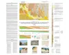
Geologic map of the Southeast Part of the Austin, Texas, 30x60 Minute Quadrangle; Central Texas Population Corridor Encompassing Bastrop and Smithville |
2008 |
|
Collins, E.W. |
Miscellaneous Map |
Bureau of Economic Geology |
|
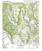
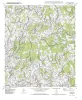
Geologic map of the Winchester quadrangle, Texas |
2001 |
|
Collins, E.W. |
Open-File Map |
Bureau of Economic Geology |
|
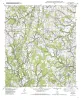
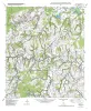
Geologic map of the Paige quadrangle, Texas |
2001 |
|
Collins, E.W. |
Open-File Map |
Bureau of Economic Geology |
|
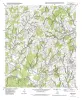
Geologic map of the Beaukiss quadrangle, Texas |
2001 |
|
Collins, E.W. |
Open-File Map |
Bureau of Economic Geology |
|
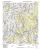
Geologic map of the Fedor quadrangle, Texas |
2001 |
|
Collins, E.W. |
Open-File Map |
Bureau of Economic Geology |
|
Geologic map of the Lexington quadrangle, Texas |
2001 |
|
Collins, E.W. |
Open-File Map |
Bureau of Economic Geology |
|
Geologic map of the McDade quadrangle, Texas |
2001 |
|
Collins, E.W. |
Open-File Map |
Bureau of Economic Geology |
|
Geologic map of the Elgin East Quadrangle, Texas |
2000 |
|
Collins, E.W. |
Open-File Map |
Bureau of Economic Geology |
|
Geologic map of the Structure Quadrangle, Texas |
2000 |
|
Collins, E.W. |
Open-File Map |
Bureau of Economic Geology |