Publications in Karnes
| Title | Publication Year Sort ascending | Abstract | Author | Series | Publisher | |
|---|---|---|---|---|---|---|
|
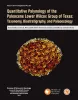
Quantitative palynology of the Paleocene Lower Wilcox Group of Texas: taxonomy, biostratigraphy, and paleoecology | 2025 | Palynological analysis of four onshore wells (Edmond Olinick No 1, Jerome Olinick No 16, Lawrence Keseling No 1, Moczygemba VT No 11) in the Paleocene Lower Wilcox Group of Texas in the United States has yielded abundant and diverse palynomorph taxa from Paleocene shallow marine deltaic paleoenvi |
Smith, Vann, Moscardelli, Lorena, Bord, D., Lorente, M.A., Olariu, M.I. | Report of Investigations | Bureau of Economic Geology |
|
Geology of the Karnes Uranium District, Texas | 2007 | D. Hoye Eargle, George Pinkley, and Paul de Vergie led and co-authored the first field trip to the Karnes Uranium District for the South Texas Geological Society in 1958, nearly 50 years ago. Since then, various field trips have been held to this area by different groups. |
Cherepon, Alan J., Brandt, Jon E., Galloway, W.E. | Austin Geological Society | Austin Geological Society |
|
Depositional and ground-water flow systems of the Carrizo - Upper Wilcox, south Texas | 1988 | In the Rio Grande Embayment of South Texas, the Carrizo Formation (lower Eocene) consists of two sand-rich fluvial depositional systems that grade basinward into several deltaic complexes within the upper part of the Wilcox Group. |
Hamlin, H.S. | Report of Investigations | Bureau of Economic Geology |
|
The Guadalupe - Lavaca - San Antonio - Nueces River basins regional study: Seguin West - Austin West sheets | 1985 | Wermund, E.G., Gustavson, T.C., Morton, R.A., Woodruff, C.M., Jr., Macpherson, G.L., McKinney, L., Nilsson, J., Waddell, C.T. | River Basins Regional Studies | Bureau of Economic Geology | |
|
Depositional framework, hydrostratigraphy, and uranium mineralization of the Oakville Sandstone (Miocene), Texas coastal plain | 1982 | The Oakville Sandstone (Miocene) of the Texas Coastal Plain comprises a major sand-rich fluvial system composed of deposits of several major and minor rivers that originated within Texas and surrounding states. |
Galloway, W.E., Henry, C.D., Smith, G.E. | Report of Investigations | Bureau of Economic Geology |
|
Geochemistry of ground water in the Miocene Oakville Sandstone -- a major aquifer and uranium host of the Texas coastal plain | 1982 | The Oakville Sandstone is a major aquifer and a major host of uranium deposits in the Texas Coastal Plain. |
Henry, C.D., Galloway, W.E., Smith, G.E., Ho, C.L., Morton, J.P., Gluck, J.K. | Report of Investigations | Bureau of Economic Geology |
|
Regional hydrodynamics and hydrochemistry of the uranium-bearing Oakville aquifer (Miocene) of south Texas | 1982 | The Oakville Formation consists of sediments deposited by several major fluvial systems that traversed the Texas Coastal Plain during the Miocene Epoch. |
Smith, G.E., Galloway, W.E., Henry, C.D., Gluck, J.K., McIntyre, J.F., Pisasale, E.T., Spradlin, S.D. | Report of Investigations | Bureau of Economic Geology |
|
Considerations in the extraction of uranium from a fresh-water aquifer -- Miocene Oakville Sandstone, south Texas | 1982 | The Miocene Oakville Sandstone is a major aquifer and uranium host beneath the Texas Coastal Plain. In 1976, approximately 6,000 acre-ft of ground water were withdrawn from the Oakville for municipal use. |
Henry, C.D., Galloway, W.E., Smith, G.E., Childs, C.S., Devine, P.E., Dutton, A.R., Gluck, J.K., McIntyre, J.F. | Report of Investigations | Bureau of Economic Geology |
|
Upper Tertiary and Quaternary depositional systems, central coastal plain, Texas -- regional geology of the coastal aquifer and potential liquid-waste repositories | 1981 | Upper Miocene, Pliocene, and Pleistocene deposits in the subsurface of the central Coastal Plain of Texas were subdivided into six operational units comprising the surface-defined Fleming, Goliad, Willis, Lissie, and Beaumont Formations. |
Solis-Iriarte, R.F. | Report of Investigations | Bureau of Economic Geology |
|
Depositional and diagenetic history of the Sligo and Hosston Formations(Lower Cretaceous) in south Texas | 1981 | The Sligo and Hosston Formations of Aptian age occur over thousands of square miles in the subsurface of South Texas. |
Bebout, D.G., Budd, D.A., Schatzinger, R.A. | Report of Investigations | Bureau of Economic Geology |