Publications in Garza
| Title | Publication Year Sort ascending | Abstract | Author | Series | Publisher | |
|---|---|---|---|---|---|---|
|
Stratigraphic analysis of the Upper Devonian Woodford Formation, Permian Basin, West Texas and southeastern New Mexico | 1991 | The Upper Devonian Woodford Formation is an organic-rich petroleum source rock that extends throughout West Texas and southeastern New Mexico and currently is generating oil or gas in the subsurface. |
Comer, J.B. | Report of Investigations | Bureau of Economic Geology |

|
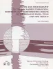
Hydrogeology and hydrochemistry of the Ogallala aquifer, southern High Plains, Texas panhandle and eastern New Mexico | 1988 | The Ogallala aquifer, which underlies the Southern High Plains, consists of the saturated sediments of the Neogene Ogallala Formation. The aquifer is the main source of water for the High Plains of Texas and New Mexico and is being severely depleted by extensive pumpage for irrigation. |
Nativ, Ronit | Report of Investigations | Bureau of Economic Geology |
|
Bouguer gravity Atlas of Texas, Big Spring sheet | 1986 | This folded transparent map is at the same scale as its corresponding Geologic Atlas of Texas (GAT) sheet and can be superimposed on it to compare gravity information with surface geology. |
Keller, G.R., Aiken, C.L.V. | Bouguer Gravity Atlas of Texas | Bureau of Economic Geology |
|
Bouguer gravity Atlas of Texas, Lubbock sheet | 1986 | This folded transparent map is at the same scale as its corresponding Geologic Atlas of Texas (GAT) sheet and can be superimposed on it to compare gravity information with surface geology. |
Keller, G.R., Aiken, C.L.V. | Bouguer Gravity Atlas of Texas | Bureau of Economic Geology |
|
Genesis and emplacement of oil in the San Andreas Formation, northern shelf of the Midland basin, Texas | 1982 | San Andres oil constitutes more than 80 percent of the total production from the Northern Shelf of the Midland Basin, Texas. |
Ramondetta, P.J. | Report of Investigations | Bureau of Economic Geology |
|
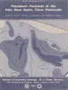
Petroleum potential of the Palo Duro basin, Texas panhandle | 1982 | The Palo Duro Basin seemingly has all the elements necessary for hydrocarbon generation and accumulation: reservoirs, traps, source rocks, and sufficient thermal maturity. Porous facies in pre-Pennsylvanian, Pennsylvanian, and Permian strata are potential hydrocarbon reservoirs. |
Dutton, S.P., Goldstein, A.G., Ruppel, S.C. | Report of Investigations | Bureau of Economic Geology |
|
Facies and stratigraphy of the San Andreas Formation, northern and northwestern shelves of the Midland basin, Texas and New Mexico | 1982 | The San Andres Formation on the Northern and Northwestern Shelves of the Midland Basin is a progradational stratigraphic unit consisting predominantly of carbonate facies. Lithofacies include dolomite, laminated anhydrite and dolomite, massive bedded anhydrite, limestone, salt, and red beds. |
Ramondetta, P.J., Guetzow, D.D., Dauzat, Rick, Merritt, R.M., Garza, John, Holman, Lee, Roques, Dominick | Report of Investigations | Bureau of Economic Geology |
|
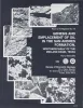
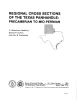
Regional cross sections of the Texas panhandle: Precambrian to mid-Permian | 1981 | The Texas Panhandle traditionally has been an important source of mineral resources, especially petroleum, and resources will continue to contribute heavily to the economy of the area. The seven cross sections of this report synthesize the subsurface geology of the region. |
Handford, C.R., Dutton, S.P., Fredericks, P.E. | Cross Sections | Bureau of Economic Geology |
|
Sand-body geometry and depositional systems, Ogallala Formation, Texas | 1980 | The Neogene Ogallala Formation is an alluvial apron that occurs east of the Rocky Mountains from South Dakota to the Southern High Plains of Texas. The Ogallala was deposited by coalescent, low-gradient, wet alluvial fans that headed in mountains to the west. |
Seni, S.J. | Report of Investigations | Bureau of Economic Geology |
|
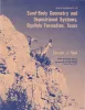
Depositional framework of the Lower Dockum Group (Triassic), Texas panhandle | 1979 | The Upper Triassic Dockum Group of Texas and New Mexico is composed of 200 to 2,000 feet of complexly interrelated terrigenous clastic facies ranging from mudstone to conglomerate. |
McGowen, J.H., Granata, G.E., Seni, S.J. | Report of Investigations | Bureau of Economic Geology |