Publications in Crosby
| Title | Publication Year Sort ascending | Abstract | Author | Series | Publisher | |
|---|---|---|---|---|---|---|
|
Depositional systems and hydrocarbon resource potential of the Pennsylvanian system, Palo Duro and Dalhart Basins, Texas panhandle | 1980 | Pennsylvanian clastic and carbonate strata were deposited in a variety of environments within the Palo Duro Basin. Maximum accumulation (totaling 750 m or 2,400 ft) occurred along a northwest-southeast axis. |
Dutton, S.P. | Geological Circular | Bureau of Economic Geology |

|
Petroleum source rock potential and thermal maturity, Palo Duro basin, Texas | 1980 | Samples collected from 20 geographically widespread wells in the sparsely drilled Palo Duro Basin were analyzed for total organic carbon content (TOC). Highest values of TOC, up to 6.9 percent, occur in Upper Permian San Andres dolomite in the southern part of the basin. |
Dutton, S.P. | Geological Circular | Bureau of Economic Geology |

|
Depositional framework of the Lower Dockum Group (Triassic), Texas panhandle | 1979 | The Upper Triassic Dockum Group of Texas and New Mexico is composed of 200 to 2,000 feet of complexly interrelated terrigenous clastic facies ranging from mudstone to conglomerate. |
McGowen, J.H., Granata, G.E., Seni, S.J. | Report of Investigations | Bureau of Economic Geology |

|
Geology and geohydrology of the Palo Duro Basin, Texas panhandle -- a report on the progress of nuclear waste isolation feasibility studies (1978) | 1979 | Integrated, detailed, and comprehensive study of the physical stratigraphy, tectonic history, hydrogeology, geomorphology, and resource potential of the Palo Duro and Dalhart Basins, Texas Panhandle, is part of a national evaluation of ancient salt basins as potential sites for isolation and mana |
Dutton, S.P., Finley, R.J., Galloway, W.E., Gustavson, T.C., Handford, C.R., Presley, M.W. | Geological Circular | Bureau of Economic Geology |
|
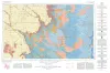
Geologic Atlas of Texas, Lubbock sheet (revised 1993) | 1967 | Geologic map that depicts surface geology of Crosby, Dickens, and King Counties and parts of Hale, Floyd, Motley, Cottle, King, Lubbock, Lynn, Garza, Kent, and Stonewall Counties. The Lubbock Sheet honors the late Dr. |
Eifler, G.K., Frye, J.C., Leonard, A.B., Hentz, T.F., Barnes, V.E. | Geologic Atlas of Texas | Bureau of Economic Geology |
|
Subsurface Woodford black shale, West Texas and southeast New Mexico | 1950 | The geographic distribution, lithology, thickness, and paleontology of the subsurface Woodford in the Permian basin are described and illustrated. |
Ellison Jr., S.P. | Report of Investigations | Bureau of Economic Geology |