Publications in Cherokee
| Title | Publication Year Sort ascending | Abstract | Author | Series | Publisher | |
|---|---|---|---|---|---|---|
|
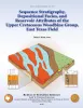
Sequence Stratigraphy, Depositional Facies, and Reservoir Attributes of the Upper Cretaceous Woodbine Group, East Texas Field | 2010 | Although the mature, supergiant East Texas field on the west flank of the Sabine Uplift has been producing from the Upper Cretaceous (Cenomanian) siliciclastic Woodbine Group for more than 75 years, no modern comprehensive geologic study of it has been completed. |
Hentz, T.F. | Report of Investigations | Bureau of Economic Geology |
|
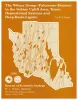
The Wilcox Group (Paleocene - Eocene) in the Sabine uplift area, Texas: depositional systems and deep-basin lignite | 1990 | Kaiser, W.R., Jackson, M.L.W., Sutley, A.M., Fly, D.J., Dobson, R.E. | Geological Folios | Bureau of Economic Geology | |
|
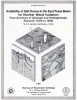
Suitability of salt domes in the east Texas basin for nuclear waste isolation: final summary of geologic and hydrologic research (1978 to 1983) | 1984 | This report summarizes results of the East Texas Waste Isolation (ETWI) program from January 1, 1978, to March 30, 1983. Having an extensive data base, the study comprised 33 different lines of research by 67 scientists and research assistants. |
Jackson, M.P.A., Seni, S.J. | Geological Circular | Bureau of Economic Geology |
|
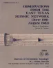
Observations from the east Texas seismic network (June 1981 - August 1982) | 1984 | Several microearthquake recording stations were operated as a network in the East Texas Basin beginning in June 1981. At least six certain and two probable earthquakes as well as hundreds of events of undetermined origin were recorded through August 1982. |
Pennington, W.D., Carlson, S.M. | Geological Circular | Bureau of Economic Geology |
|
Sedimentary record of Cretaceous and Tertiary salt movement, east Texas basin: times, rates, and volumes of salt flow and their implications for nuclear waste isolation and petroleum exploration | 1984 | Post-Aptian strata (younger than 112 ma) in the East Texas Basin were strongly influenced by halokinesis and recorded the evolution associated sate structures. |
Seni, S.J., Jackson, M.P.A. | Report of Investigations | Bureau of Economic Geology |
|
Regional aquifer characterization for deep-basin lignite mining, Sabine uplift area, northeast Texas | 1983 | Lignite deeper than 200 ft (61 m) constitutes about 60 percent of the total lignite resources in Texas. Projections indicate that meeting future demand will require mining this deep-basin lignite. |
Fogg, G.E., Kaiser, W.R., Ambrose, M.L., Macpherson, G.L. | Geological Circular | Bureau of Economic Geology |

|
Depositional systems in the Nacatoch Formation (Upper Cretaceous), northeast Texas and southwest Arkansas | 1983 | The Nacatoch Formation of the East Texas Basin is the middle formation of the Navarro Group and consists of marine sandstones and mudstones derived largely from source areas to the northwest, north, and northeast of the East Texas Embayment. |
McGowan, M.K., Lopez, C.M. | Report of Investigations | Bureau of Economic Geology |
|
Fault tectonics of the east Texas basin | 1982 | Principal fault systems in the East Texas Basin were examined in terms of their distribution, geometry, displacement history, and possible origins. |
Jackson, M.P.A., Wilson, B.D. | Geological Circular | Bureau of Economic Geology |
|
Hydrocarbon accumulation patterns in the east Texas salt dome province | 1982 | Mobilization of the Louann Salt created the present structural configuration in the central part of the East Texas Basin and was the major control on hydrocarbon accumulation in the area. Salt-cored anticlines, turtle-structure anticlines, and salt diapirs were produced by flow of salt. |
Wood, D.H., Giles, A.B. | Geological Circular | Bureau of Economic Geology |
|
Ground-water hydraulics and hydrochemical facies in Eocene aquifers of the east Texas basin | 1982 | Eocene stratigraphic units in the East Texas Basin are composed of a thick sedimentary sequence (approximately 2,000 ft [600 m]) of fresh-water aquifers and aquitards covering an area of approximately 15,000 mi2 (51,000 km2). |
Fogg, G.E., Kreitler, C.W. | Report of Investigations | Bureau of Economic Geology |