Publications by Woodruff, C.M., Jr.
| Title | Publication Year Sort ascending | Abstract | Author | Series | Publisher | |
|---|---|---|---|---|---|---|
|
Austin Chalk in It's Type Area - Stratigraphy and Structure | 1985 | Young, K.P., Woodruff, C.M., Jr. | Austin Geological Society | Austin Geological Society | |
|
Hydrogeology of Edwards Aquifer-Barton Springs Segment, Travis and Hays Counties, Texas | 1984 | Woodruff, C.M., Jr., Slade, Raymond M., Jr. | Austin Geological Society | Austin Geological Society | |
|
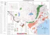
Geothermal resources of Texas, 1982 | 1982 | This public-oriented user map shows the generalized extent of geothermal aquifers in Texas. It includes locations and tabular data for selected wells that have representative temperatures and water-quality attributes of the various aquifers. |
Woodruff, C.M., Jr., Caprio, Laura, Gever, Christine | Energy and Mineral Resource Maps | Bureau of Economic Geology |
|
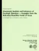
Lineament analysis and inference of geologic structure -- examples from the Balcones/Ouachita trend of Texas | 1982 | Lineaments perceived in remotely sensed images are reliable indicators of geologic structure. |
Caran, S.C., Woodruff, C.M., Jr., Thompson, E.J. | Geological Circular | Bureau of Economic Geology |
|
Land resource overview of the Capital Area Planning Council Region, Texas -- a nontechnical guide | 1979 | Bastrop, Blanco, Burnet, Caldwell, Fayette, Hays, Lee, Llano, Travis, and Williamson Counties make up the Capital Area Planning Council (CAPCO) region in Central Texas (fig. 1). The region covers 8,427 square miles (21,826 km2) and includes land of great physical diversity. |
Woodruff, C.M., Jr. | Selected Reports | Bureau of Economic Geology |
|
Land capability in the Lake Travis vicinity, Texas -- a practical guide for the use of geologic and engineering data | 1975 | The Lake Travis vicinity lies predominantly within a carbonate rock terrane and is the site of ongoing intensive residential development. |
Woodruff, C.M., Jr. | Report of Investigations | Bureau of Economic Geology |