Publications by Hentz, T.F.
| Title | Publication Year Sort ascending | Abstract | Author | Series | Publisher | |
|---|---|---|---|---|---|---|
|
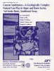
Canyon sandstones -- a geologically complex natural gas play in slope and basin facies, Val Verde basin, southwest Texas | 1995 | Canyon sandstones form a prolific low-permeability gas play in the Val Verde Basin of southwest Texas. Exploration and development activity is at a high level, but little published information on Canyon geology is available. |
Hamlin, H.S., Clift, S.J., Dutton, S.P., Hentz, T.F., Laubach, S.E. | Report of Investigations | Bureau of Economic Geology |
|
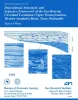
Depositional, structural, and sequence framework of the gas-bearing Cleveland Formation (Upper Pennsylvanian), western Anadarko basin, Texas panhandle | 1994 | ow-permeability ("tight") reservoir sandstones of the lower Missourian Cleveland formation produced more than 435 billion cubic feet (Bcf) of natural gas through December 1990, mostly from Ochiltree and Lipscomb Counties in the northeastern Texas Panhandle. |
Hentz, T.F. | Report of Investigations | Bureau of Economic Geology |
|
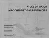
Atlas of Major Midcontinent Gas Reservoirs | 1993 | Bebout, D.G., White, W.A., Hentz, T.F., Grasmick, M.K. | Atlases of Major Oil and Gas Reservoirs | Bureau of Economic Geology | |
|
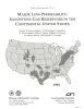
Major low-permeability-sandstone gas reservoirs in the continental United States | 1993 | This report summarizes geologic, engineering, and production information on 24 low-permeability, gas-bearing sandstone reservoirs in 13 basins in the United States. |
Dutton, S.P., Clift, S.J., Hamilton, D.S., Hamlin, H.S., Hentz, T.F., Howard, W.E., Akhter, M.S., Laubach, S.E. | Report of Investigations | Bureau of Economic Geology |
|
Atlas of Major Central and Eastern Gulf Coast Gas Reservoirs | 1992 | The Atlas of Major Central and Eastern Gulf Coast Gas Reservoirs is the second in a series compiling geologic and engineering data on natural gas reservoirs in the major gas-producing regions of the United States. |
Bebout, D.G., White, W.A., Garrett, C.M., Jr., Hentz, T.F. | Atlases of Major Oil and Gas Reservoirs | Bureau of Economic Geology |
|
Geologic occurrence and regional assessment of evaporite-hosted native sulfur, Trans-Pecos Texas | 1989 | In the western Delaware Basin and southern Central Basin Platform of Trans-Pecos Texas, Upper Permian (Ochoan) evaporite strata host locally voluminous but notoriously unpredictable, sporadic deposits of biogenic native sulfur. |
Hentz, T.F., Price, J.G., Gutierrez, G.N. | Report of Investigations | Bureau of Economic Geology |
|
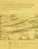
Lithostratigraphy and paleoenvironments of Upper Paleozoic continental red beds, north-central Texas: Bowie (new) and Wichita (revised) Groups | 1988 | Approximately 2,200 ft (670 m) of principally continental and paralic rocks of late Virgilian, Wolfcampian, and early Leonardian age (late Pennsylvanian and early Permian) are exposed in an area of about 4,950 mi2 (12,800 km2) between the Brazos and Red Rivers in North-Central Texas. |
Hentz, T.F. | Report of Investigations | Bureau of Economic Geology |
|
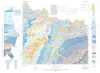
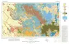
Geologic Atlas of Texas, Wichita Falls-Lawton sheet | 1987 | Geologic map that depicts the surface geology of Hardeman, Wilbarger, Wichita, Clay, Knox, Baylor, Archer, Haskell, Throckmorton, Young, and Foard Counties and part of Jack County, Texas. The 20-page booklet indicates geologic formations, abbreviations, and ages. |
Barnes, V.E., Hentz, T.F., Brown, L.F., Jr., Cleaves, A.W., Kier, R.S., McGowen, J.H., Parrish, W.C., Ramsey, J.W. | Geologic Atlas of Texas | Bureau of Economic Geology |
|
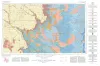
Geologic Atlas of Texas, Big Spring sheet (revised 1994) | 1974 | Geologic map that depicts the surface geology of Borden, Scurry, Fisher, Martin, Howard, Mitchell, and Nolan Counties and parts of Glasscock, Sterling, Coke, Runnels, Taylor, Jones, Dawson, Martin, Lynn, Garza, Kent, and Stonewall Counties. |
Eifler, G.K., Frye, J.C., Leonard, T.F., Barnes, V.E., Trollinger-Gusney and Assoc., Shell Oil Co., Humble Oil and Refining Co., Southern Minerals Corp. | Geologic Atlas of Texas | Bureau of Economic Geology |
|
Geologic Atlas of Texas, Lubbock sheet (revised 1993) | 1967 | Geologic map that depicts surface geology of Crosby, Dickens, and King Counties and parts of Hale, Floyd, Motley, Cottle, King, Lubbock, Lynn, Garza, Kent, and Stonewall Counties. The Lubbock Sheet honors the late Dr. |
Eifler, G.K., Frye, J.C., Leonard, A.B., Hentz, T.F., Barnes, V.E. | Geologic Atlas of Texas | Bureau of Economic Geology |