
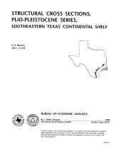
These cross sections illustrate the regional structure and stratigraphy beneath the Texas continental shelf . The Plio-Pleistocene Series in the western Gulf Coast basin comprises a thick wedge of terrigenous clastic sediment that produces modest volumes of hydrocarbons from offshore leases along the outer shelf and upper slope. Sandstone reservoirs within this wedge have yielded more than 40 million bbl of oil and 2.5 Tcf of gas.
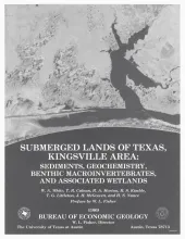
The State-owned submerged lands of Texas encompass almost 6,000 mi2 (15,540 km2). They lie below waters of the bay-estuary-lagoon system and the Gulf of Mexico and extend 10.3 mi (16.6 km) seaward from the Gulf shoreline (fig. 1). The importance of these lands and their resources to resident flora and fauna as well as to people is well known and documented; more than one-third of the state's population is concentrated within an area of the Coastal Zone that is only about one-sixteenth of the state's land area.
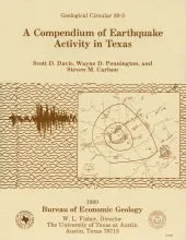
A comprehensive review of Texas earthquakes from 1847 to 1986 has revealed 106 earthquakes of magnitude 3 or greater; of these, 24 are earthquakes for which reports of damage are available, and 1 was responsible for a human fatality. All known reports on Texas seismicity are incorporated in this circular, including original "felt" (eyewitness) reports from contemporary newspapers and other sources.
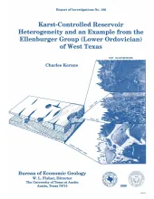
This study is a product of ongoing Bureau of Economic Geology investigations, by means of geologic and petrophysical modeling, into the nature of reservoir compartmentalization or heterogeneity. The model has been designed to provide a basis for subsequent infill drilling in the reservoirs in question along trends of greatest geologic potential, rather than according to geometrically defined well spacings.The Lower Ordovician Ellenburger Group was the site of the investigations from which more than 10,000 ft (3,050 m) of core from 63 wells was logged.
In 1983, the Bureau of Economic Geology published the Atlas of Major Texas Oil Reservoirs, a precedent-setting synthesis of key geological and engineering data on 450 major oil reservoirs grouped into 48 regional plays. This volume, the Atlas of Major Texas Gas Reservoirs, is a companion to the earlier work. It contains information on more than 1,828 reservoirs, with emphasis on 868 reservoirs having cumulative production greater than 30 billion cubic feet of natural gas.