|
Prospecting for Uranium in Texas |
Flawn, P.T., Anderson, G.H. |
1955 |
Mineral Resource Circular |
|
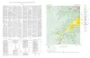
Mineral Resources of the Texas Coastal Plain (Preliminary Report) |
Perkins, J.M., Lonsdale, J.T. |
1955 |
Mineral Resource Circular |
|
Cross section, Post-Ellenburger beds, Coke, Runnels, Coleman, and Brown Counties, Texas |
Morey, P.S. |
1955 |
Miscellaneous Map |
|
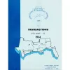
GCAGS Transactions Volume 5 (1955), Biloxi |
|
1955 |
Gulf Coast Association of Geological Societies |
|
Miocene Equidae of the Texas Gulf Coastal Plain |
Quinn, J.H. |
1955 |
UT Publication |
|
Cathedral Mountain quadrangle, Brewster County, Texas |
McAnulty, W.N. |
1955 |
Miscellaneous Map |
|
Geology of Cathedral Mountain quadrangle, Brewster County, Texas |
McAnulty, W.N. |
1955 |
Report of Investigations |
|
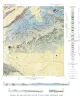
Map showing correlation of geologic, gravity, and magnetic observations, Blanco and Gillespie Counties, Texas |
Barnes, V.E., Romberg, Frederick, Anderson, W.A. |
1955 |
Miscellaneous Map |
|
Geologic map of the Harper quadrangle, Gillespie County, Texas |
Barnes, V.E. |
1954 |
Geologic Quadrangle Map |
|
Geologic map of the Dry Branch quadrangle, Gillespie and Kerr Counties, Texas |
Barnes, V.E. |
1954 |
Geologic Quadrangle Map |
|
Geologic map of the Klein Branch quadrangle, Gillespie and Kerr Counties, Texas |
Barnes, V.E. |
1954 |
Geologic Quadrangle Map |
|
GCAGS Transactions Volume 4 (1954), Houston |
|
1954 |
Gulf Coast Association of Geological Societies |
|
Geologic map of the Threadgill Creek quadrangle, Gillespie and Kerr Counties, Texas |
Barnes, V.E. |
1954 |
Geologic Quadrangle Map |
|
Geology of Hood Spring quadrangle, Brewster County, Texas |
Graves, R.W. |
1954 |
Report of Investigations |
|
Handbook of Cretaceous Foraminifera of Texas |
Frizzell, D.L. |
1954 |
Report of Investigations |
|
Geologic Map and Structure Sections of Hood Spring Quadrangle, Texas |
Graves, R.W. |
1954 |
Miscellaneous Map |
|
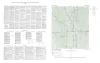
Phosphorite in eastern Llano uplift of central Texas |
Barnes, V.E. |
1954 |
Report of Investigations |
|
The faunas of the Riley Formation in central Texas |
Palmer, A.R. |
1954 |
Report of Investigations |
|
Geologic map of the Wendel Quadrangle, Kimble, Kerr, and Gillespie Counties, Texas |
Barnes, V.E. |
1954 |
Geologic Quadrangle Map |
|
Geology of the Agua Fria quadrangle, Brewster County, Texas |
Moon, C.G. |
1953 |
Report of Investigations |