|
Field excursion, eastern Llano region |
Barnes, V.E. |
1958 |
Guidebook |
|
Pleistocene Equidae of Texas |
Quinn, J.H. |
1957 |
Report of Investigations |
|
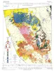
Geologic map of Wylie Mountains and Vicinity, Culberson and Jeff Davis Counties, Texas |
Hay-Roe, Hugh |
1957 |
Geologic Quadrangle Map |
|
GCAGS Transactions Volume 7 (1957), New Orleans |
|
1957 |
Gulf Coast Association of Geological Societies |
|
Geologic Maps, Central Texas (selected areas), 1957 and 1959 |
Whitney, F.L. |
1957 |
Miscellaneous Map |
|
Pelecypoda from the Type Locality of the Stone City Beds (Middle Eocene) of Texas |
Stenzel, H.B., Krause, E.K., Twining, J.T. |
1957 |
UT Publication |
|
Occurrence of Oil and Gas in West Texas |
Herald, F.A. |
1957 |
UT Publication |
|
Geology of Parker County, Texas |
Hendricks, Leo |
1957 |
UT Publication |
|
Upper Albian (Cretaceous) Ammonoidea from Texas |
Young, Keith |
1957 |
Report of Investigations |
|
Ecological Interpretations of Pliocene and Pleistocene Stratigraphy in the Great Plains Region, |
Frye, J.C., Leonard, A.B. |
1957 |
Report of Investigations |
|
A preliminary report on the stratigraphy of the uranium-bearing rocks of the Karnes County area, south-central Texas |
Eargle, D.H., Snider, J.L. |
1957 |
Report of Investigations |
|
Devonian - Mississippian transition in central Texas |
Cloud, P.E., Jr., Barnes, V.E., Hass, W.H. |
1957 |
Report of Investigations |
|
Studies of Cenozoic geology along eastern margin of Texas high plains, Armstrong to Howard Counties |
Frye, J.C., Leonard, A.B. |
1957 |
Report of Investigations |
|
Geologic map of the Fall Prong Quadrangle, Kimble, Gillespie and Mason Counties, Texas |
Barnes, V.E. |
1956 |
Geologic Quadrangle Map |
|
Enchanted rock batholith, Llano and Gillespie Counties, Texas |
Hutchinson, R.M. |
1956 |
Miscellaneous Map |
|
GCAGS Transactions Volume 6 (1956), San Antonio |
|
1956 |
Gulf Coast Association of Geological Societies |
|
Basement Rocks of Texas and Southeast New Mexico |
Flawn, P.T. |
1956 |
UT Publication |
|
Geology of the Late Paleozoic Horseshoe Atoll in West Texas |
Myers, D.A., Stafford, P.T., Burnside, R.J. |
1956 |
UT Publication |
|
Lead deposits in the Upper Cambrian of central Texas |
Barnes, V.E. |
1956 |
Report of Investigations |
|
Some uranium occurrences in West Texas |
Eargle, D.H. |
1956 |
Report of Investigations |