Publications in Midland
| Title | Publication Year Sort ascending | Abstract | Author | Series | Publisher | |
|---|---|---|---|---|---|---|
|
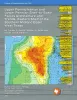
Upper Pennsylvanian and Lower Permian Shelf-to-Basin Facies Architecture and Trends, Eastern Shelf of the Southern Midland Basin, West Texas | 2017 | Our study documents the shelf, shelf-edge, slope, and basin-floor depositional facies characteristics, stratigraphic variations, and sedimentation trends of the Missourian Canyon Group and Virgilian–Wolfcampian Cisco Group across the southern Eastern Shelf and the adjacent Midland Basin. |
Hentz, T.F., Ambrose, W.A., Hamlin, H.S. | Report of Investigations | Bureau of Economic Geology |
|
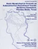
Basin morphological controls on submarine-fan depositional trends: Spraberry Sandstone, Permian Basin, Texas | 1997 | The Leonardian Spraberry Formation is a major oil-producing formation of the Permian Basin, accounting for more than 700 million barrels of oil produced from heterogeneous submarine-fan reservoirs. |
Tyler, Noel, Gholston, J.C., Guevara, E.H. | Geological Circular | Bureau of Economic Geology |
|
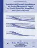
Depositional and diagenetic facies patterns and reservoir development in Silurian and Devonian rocks of the Permian basin | 1994 | Silurian and Devonian carbonate and chert rocks in the Permian Basin constitute a prolific hydrocarbon-bearing succession in West Texas and New Mexico. |
Ruppel, S.C., Holtz, M.H. | Report of Investigations | Bureau of Economic Geology |
|
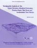
Stratigraphic analysis of the Upper Devonian Woodford Formation, Permian Basin, West Texas and southeastern New Mexico | 1991 | The Upper Devonian Woodford Formation is an organic-rich petroleum source rock that extends throughout West Texas and southeastern New Mexico and currently is generating oil or gas in the subsurface. |
Comer, J.B. | Report of Investigations | Bureau of Economic Geology |
|
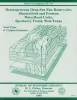
Heterogeneous deep-sea fan reservoirs, Shackelford and Preston waterflood units, Spradberry trend, West Texas | 1988 | The Permian Spraberry Trend, once regarded as the world's largest uneconomic oil field, is a prime candidate for reserve growth through extended conventional recovery. |
Tyler, Noel, Gholston, J.C. | Report of Investigations | Bureau of Economic Geology |
|
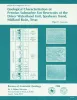
Geological characterization of Permian submarine fan reservoirs of the Driver Waterflood Unit, Spraberry trend, Midland basin, Texas | 1988 | More than 350 well logs and core and production data were used to geologically characterize oil reservoirs of the Driver waterflood unit of the Spraberry Trend in the Midland Basin, West Texas, and to assess the relationship between reservoir stratigraphy and oil recovery. |
Guevara, E.H. | Report of Investigations | Bureau of Economic Geology |
|
Middle-Upper Miocene depositional sequences of the Texas coastal plain and continental shelf: geologic framework, sedimentary facies, and hydrocarbon plays | 1988 | Middle-upper Miocene depositional sequences of offshore Texas represent the last regionally significant influx of terrigenous elastic sediments into the western Gulf Coast Basin. |
Morton, R.A., Jirik, L.A., Galloway, W.E. | Report of Investigations | Bureau of Economic Geology |

|
Hydrogeology and hydrochemistry of the Ogallala aquifer, southern High Plains, Texas panhandle and eastern New Mexico | 1988 | The Ogallala aquifer, which underlies the Southern High Plains, consists of the saturated sediments of the Neogene Ogallala Formation. The aquifer is the main source of water for the High Plains of Texas and New Mexico and is being severely depleted by extensive pumpage for irrigation. |
Nativ, Ronit | Report of Investigations | Bureau of Economic Geology |
|
Bouguer gravity Atlas of Texas, Big Spring sheet | 1986 | This folded transparent map is at the same scale as its corresponding Geologic Atlas of Texas (GAT) sheet and can be superimposed on it to compare gravity information with surface geology. |
Keller, G.R., Aiken, C.L.V. | Bouguer Gravity Atlas of Texas | Bureau of Economic Geology |
|
Bouguer gravity Atlas of Texas, Hobbs sheet | 1986 | This folded transparent map is at the same scale as its corresponding Geologic Atlas of Texas (GAT) sheet and can be superimposed on it to compare gravity information with surface geology. |
Keller, G.R., Aiken, C.L.V. | Bouguer Gravity Atlas of Texas | Bureau of Economic Geology |